
Drone Soil Analysis: Multispectral Remote Sensing for Soil Mapping
Maintaining healthy and productive farmland is no easy task. It requires the knowledge of different care and conditioning practices that have been honed over thousands of years.
In recent years, natural fertilizers have been replaced with synthetic nutrients in many places—a choice that allows farmers to make advanced land management decisions to maximize yields. However, achieving the natural balance of soil is still an important part of sustainable production, and farmers must be strategic about continuously monitoring their soil composition.
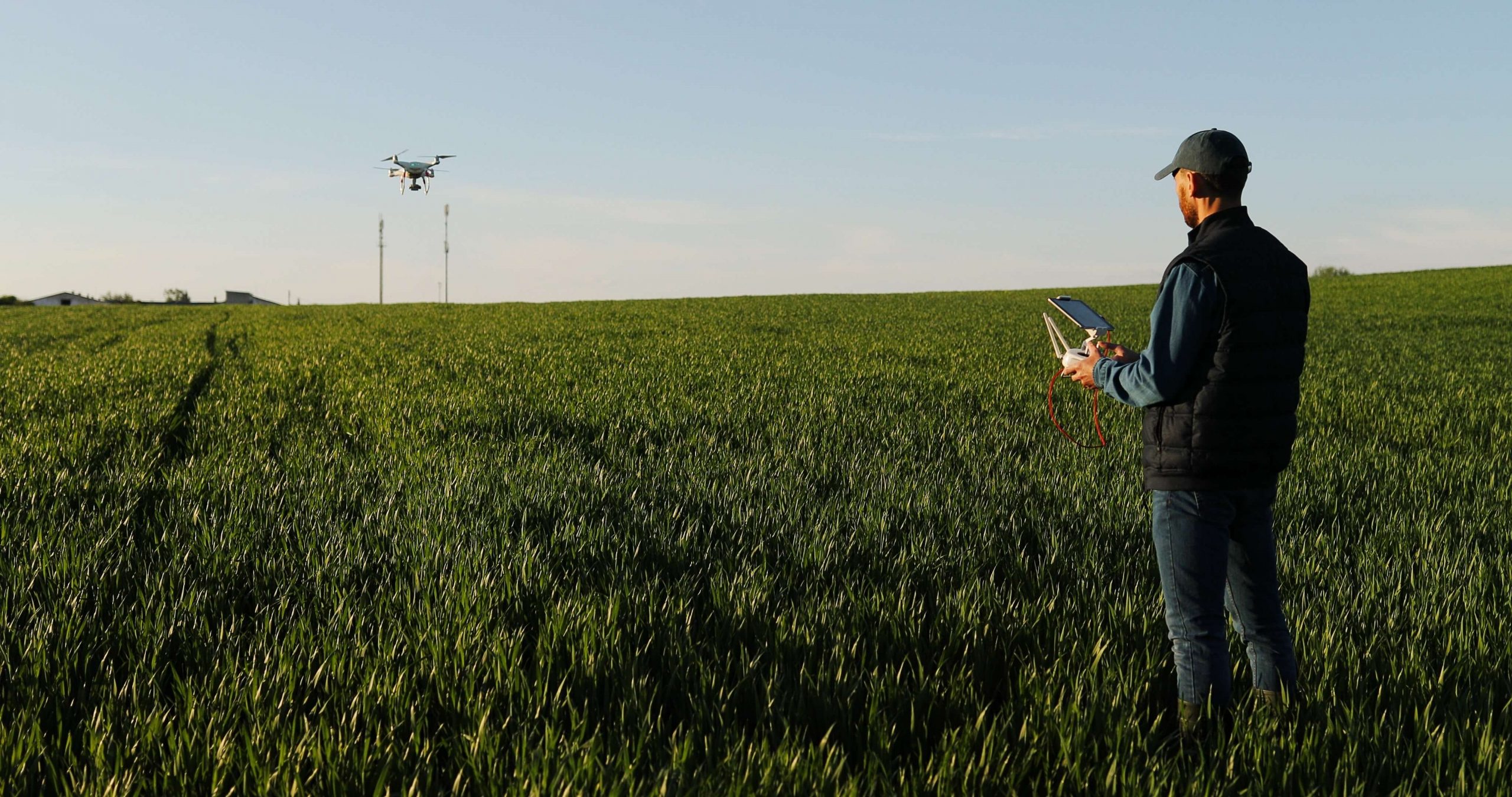
Advances in agricultural technology help farmers gather accurate data about their fields so they can make more informed decisions. One example of this type of technology is drone-enabled multispectral remote sensing for soil mapping, which has the ability to analyze acres of farmland using advanced sensors.
What Is Drone Soil Analysis?
Farmers understand that effective crop management requires a delicate balance of soil conditions and other environmental factors. Farmers cannot control rainfall, heat waves, or devastating winds, but they can effectively manage their land to prepare for these unexpected events when they arise.
Drone soil analysis refers to the use of drones to monitor soil’s nutrient levels, moisture content, and more. The ideal levels of nutrients, salinity, and moisture will vary depending on the crop in question, but the balance must be tracked closely. As a general rule, plants require a soil composition that includes:
- Non-mineral elements: Carbon, hydrogen, and oxygen
- Minerals: Nitrogen, phosphorus, potassium, and more
- pH balance: Not too alkaline, and not too acidic
Nitrogen-level management is especially important for farming. Even with today’s advanced farming practices, maintaining the right nitrogen balance in soil can be extremely difficult. Unfortunately, crops will suffer when nitrogen is scarce. At the same time, chemical-heavy farming practices can permanently damage topsoil if not carefully applied.
Thankfully, new innovations are giving farmers and researchers a bird’s-eye view of the issue.
What Is Digital Soil Mapping?
According to the U.S. Department of Agriculture, digital soil mapping refers to “the creation and population of spatial soil information systems by the use of field and laboratory observational methods, coupled with spatial and non-spatial soil inference systems.”
Digital soil mapping helps farmers predict soil classifications or properties from gathered data using an algorithm. These samples can then be used to better understand the soil landscape.
“The most exciting aspects of digital soil mapping relate to the ability of depicting smaller segments of the landscape for traditional soil classes, continuous representation of physical and chemical properties in multiple dimensions, and the associated generation of raster layers representing respective uncertainties,” explains the USDA. “These are capabilities that will allow soil scientists to more completely and thoroughly represent their soil knowledge to users than the current vector model.”
Digital Soil Mapping vs. Conventional Soil Mapping
Unlike digital soil mapping, conventional soil mapping has numerous limitations. According to the Soil Science Society of America, “Conventional soil maps, as the major data source for information on the spatial variation of soil, are limited in terms of both the level of spatial detail and the accuracy of soil attributes.”
What Is Multispectral Remote Sensing?
Drone soil analysis uses sophisticated imaging technology and unmanned aerial vehicles (UAVs, also known as drones) to gather data.
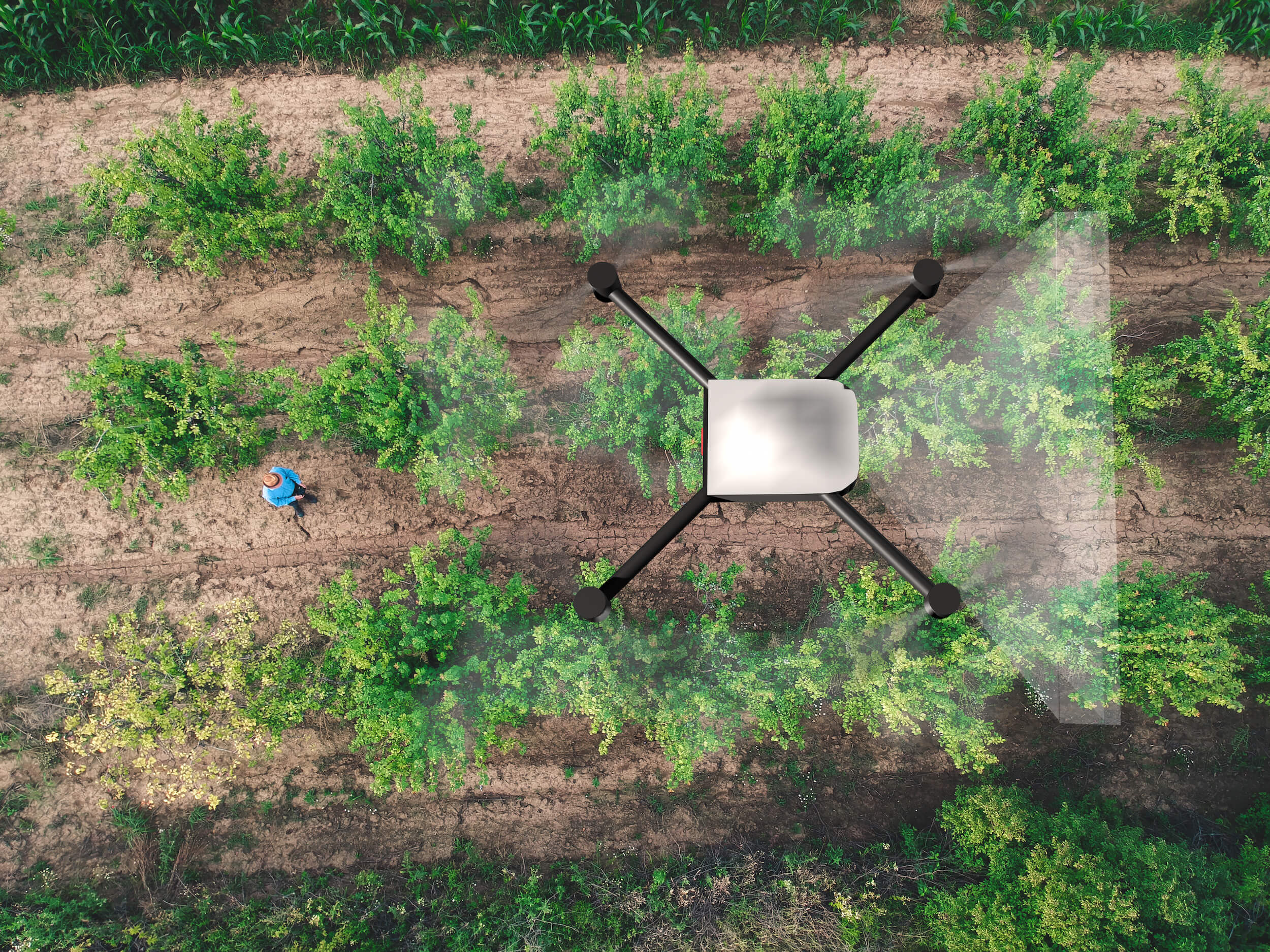
This technology performs soil mapping and field analysis using drones affixed with remote sensing cameras that collect information by measuring the electromagnetic spectrum of light reflected back from the land below. Different elements can be identified by how they reflect unique wavelengths of light. Multispectral imaging sensors collect reams of data on those wavelengths, powering advanced AI software that can pinpoint minute differences in elemental soil composition.
Using advanced geographic information system (GIS) mapping techniques and photogrammetry for landform identification, a detailed understanding of on-the-ground conditions can be produced for large amounts of land in just a short amount of time.
How Can Multispectral Imaging Help with Soil Mapping?
Using insights gathered from drone soil analysis, farmers and engineers can combine this valuable information to determine ideal seed planting patterns, appropriate watering or fertilizing strategies, and more.
Farming Productivity
The more precise measurements needed for targeted growth yields may require traditional soil sampling. However, multispectral imaging is extremely valuable for producing a scaled map of conditions across large swaths of farmland. Using multispectral maps of their fields, farmers can make more informed decisions about where to take soil samples which helps them understand the full range of soil quality across their property.
Long-Term Soil Health Monitoring
Multispectral soil mapping in agriculture can be performed regularly to get a long-term understanding of how crop production is impacting the health of the soil over time. Photogrammetry can also be used to track erosion and plant density in addition to nutrient depletion, giving farmers a valuable weapon in the fight against dangerous topsoil degradation.
Predictive Soil Quality Mapping
With advanced land monitoring technology at their fingertips, farmers and researchers can track key indicators of soil quality long after the seeds have been planted.
Soil and field analysis drones can help with monitoring soil and plant density throughout the growing season to prevent “surprises” from coming up later on. This proactive and predictive monitoring can help farmers stay ahead of unexpected issues, making changes when necessary (e.g., add nitrogen fertilizer, adjust irrigation, and so on) to maximize crop health.
Preparation for Unpredictable Environmental Factors
Proactive water monitoring, erosion prevention, and nutrient replacement place farmers in a better position to compensate for environmental factors such as long-term drought or flooding. It also allows them to prepare for short-term weather cycles, diagnose unhealthy sections in crop stands, prepare the soil for seasonal rotation, and more.
Soil Mapping: The Key to Precision Agriculture
Monitoring soil composition and conditions is important for modern farming practices. Like most things, the more accurate data you have, the better.
Multispectral soil quality maps allow farmers to make more informed decisions about where to plant certain crops and when to make adjustments. The result? Bigger, healthier yields with more sustainable land management practices.
Stay on the cutting edge of remote sensing technology with innovative solutions for your industry. Learn more about how Mapware supports advanced photogrammetry and sign up for a free trial of Mapware today.
Get on the cutting edge of remote sensing technology with innovative solutions for your industry. Learn more about how Mapware supports advanced photogrammetry and sign up for a free trial of Mapware today.

This article, originally posted on May 20, 2021, was updated May 31, 2023.