Geospatial Intelligence Constructs Better Planning for Engineers

One of the keys to successful engineering and construction is having a clear understanding of where objects are in relation to each other. Engineers use this information when planning to determine where to put foundation elements and what their specifications must be.
Essential data includes the distance between buildings and other structures, geological features, trees, and more. There are many ways to gather this information, from surveying in the field to aerial imagery and everything in between. Collectively, this data is called geospatial intelligence.
What is geospatial intelligence?
Geospatial intelligence (GEOINT) is essentially the collection of imagery intelligence and geospatial information that engineers and other professionals use to define the characteristics and locations of features on Earth. Data can be collected both from the ground through surveying and from the air. The right approach will depend on the end goals and scale of the project. In many cases, both types of data are valuable and may even be necessary.
Decision makers use the data gathered through geospatial intelligence combined with other data to paint a complete picture of the limitations and opportunities present in a particular project, whether it’s for construction, agriculture, disaster response, or insurance. Ultimately, having access to this type of actionable intelligence allows engineers to make better and more informed decisions.
Where does geospatial intelligence come from?
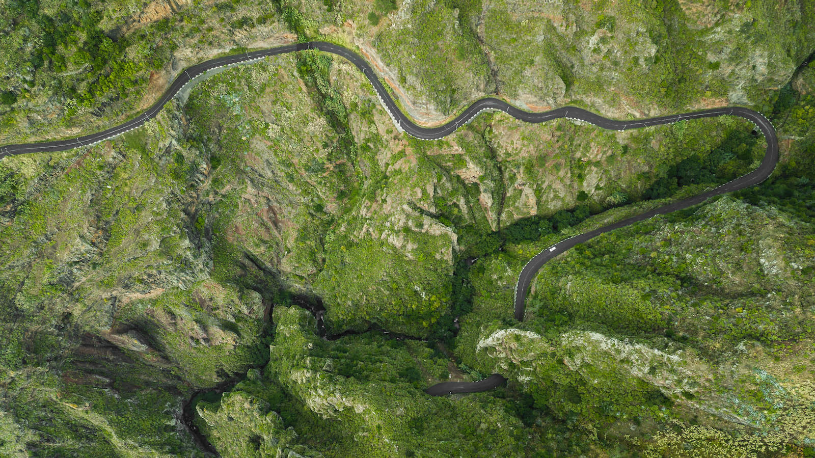
GEOINT can come from a variety of sources, but one of the most common methods is imagery collected by cameras or sensors on satellites, aircraft, or drones. Using spatial metadata, visual information, and sophisticated software tools, analysts can derive the intelligence needed for the application at hand.
Depending on the type of information desired, some of the data sources include:
- Video
- LiDAR
- Color imagery
- Infrared
- Hyperspectral
- Multispectral
Who benefits from GEOINT?
Geospatial intelligence is used in a broad range of industries and for a wide variety of applications that benefit individuals, organizations, and government, including:
- Commercial businesses: Real estate investors, oil and gas researchers, travel and tourism companies, and many other industries rely on GEOINT data to make informed decisions.
- Defense: The military uses geospatial intelligence on a daily basis to monitor areas, plan missions, execute operations, and more.
- Disaster response: Firefighters and other response teams use GEOINT to assess conditions remotely, get precise location information, and set up appropriate safety protocols before entering a hazardous zone.
- Agriculture: Farmers and consumers benefit from GEOINT with the ability to develop more efficient planting practices, minimize fertilizer use, and reduce water consumption through targeted irrigation.
How does geospatial intelligence support public civil works planning?
Accurate measurements are essential in any type of engineering. GEOINT provides this information in a range of use cases.
Structural
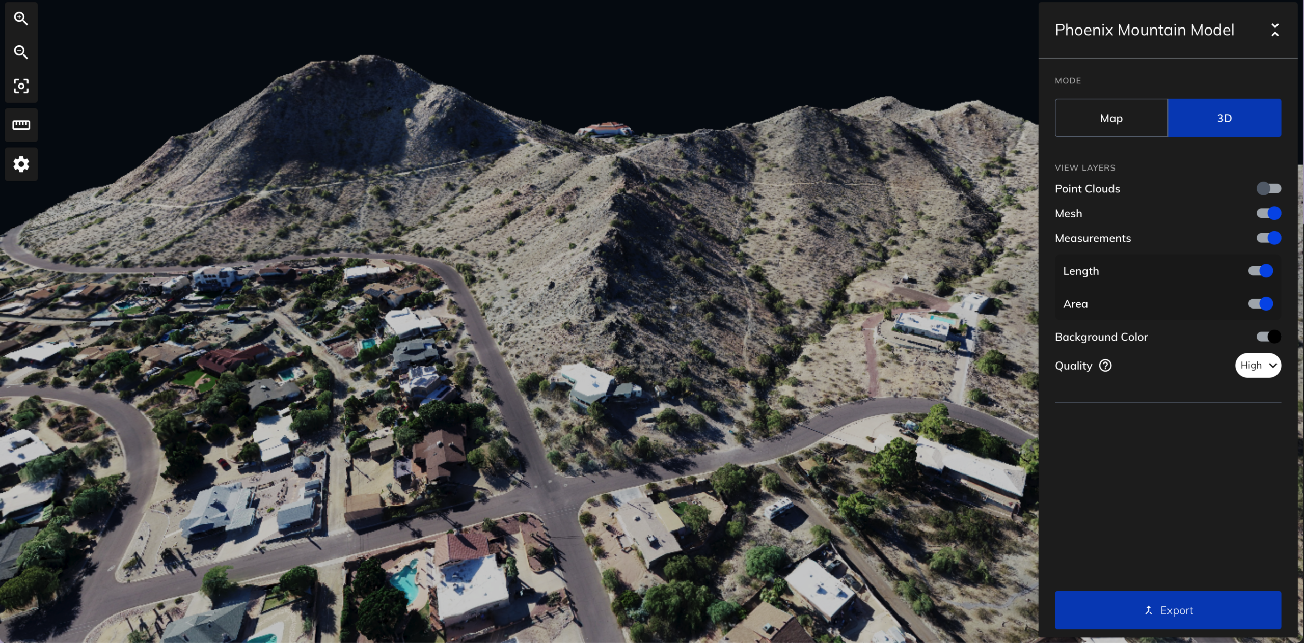
Plan for construction and evaluate existing structures with site analysis techniques such as surveying and drone mapping. Engineers can overlay imagery with 3D models, zoning maps, protected areas, and more to make informed decisions about site placement and structure orientation.
Civil
Geospatial data is also used in civil engineering for road planning and logistics and analysis of traffic flow. Overlay images with data from other sources, such as demographic information, flood projections, planned changes, and so on.
Environmental
Engineers and other professionals incorporate GEOINT data to inform environmental impact assessments, natural disaster response, and stormwater pollution prevention plans. Field data and remote sensing can be used to measure and monitor soil quality, invasive species, and other environmental factors that may impact a project. As with other applications, the data can be merged with other intelligence sources to support more informed decisions and make plans or predictions for natural disasters.
National Security
The National Geospatial-Intelligence Agency (NGA) is a government agency that provides GEOINT for the military, intelligence professionals, first responders, and more. The agency is both proactive and reactive by analyzing threats, monitoring areas across the globe, and providing real-time data to the military and first responders. Other capabilities include supporting security operations, counterterrorism activities, border patrol, and humanitarian efforts.
How do drones contribute to geospatial intelligence?
GEOINT is gathered in a number of ways, including from geographic information systems, databases, GPS coordinates, data collected in the field, and much more. No matter which tools are used to gather information, recent images and remote sensing are essential for providing an accurate depiction of the current conditions of a site.
Modern Efficiencies
Before the advent of drones, the only way to gather imagery and data from above was to take photos and videos from an elevated position, aircraft, or satellite. However, cranes or other nearby high points have limitations, flying an aircraft is expensive, and satellite imagery is not always accessible. The weather might also play a role in the ability to gather aerial imagery from aircraft or satellites.
Drones provide a more affordable and accessible means for gathering geospatial intelligence. They can be quickly deployed and are also able to fly below cloud cover and in a broader range of weather conditions.
Exploration of the Unknown
Drone technology makes it easier than ever to get a complete picture of a previously unexplored area, including accurate measurements for geospatial intelligence. Detailed maps can be created without ever stepping foot on the site. With a single drone flight, engineers can easily collect enough data and aerial imagery to support project success.
Smaller Footprint
With drones, accurate, actionable intelligence can be gathered with virtually no environmental footprint. This is particularly important in sensitive areas where access is limited or challenging. This benefit also helps reduce the cost of gathering data because there is no need to rent equipment and compliance with environmental regulations is less onerous.
Robust Data
In addition to imagery, a variety of sensors can be employed to gather specific types of data. When combined with software that provides measurements and analysis, engineers have a wealth of information at their fingertips.
Data Sharing
More data equals more informed decisions. When working across teams or groups with multiple stakeholders and consultants, having geospatial intelligence readily available improves efficiency. Being able to share and compile data from different types of geospatial professionals and multiple intelligence sources enhances collaboration and improves business outcomes.
Professional Opportunity
In addition to the technical benefits, drones can also support career development and progression for engineers. Embracing the latest technology can advance your career and contribute to company success.
Use Mapware to gather GEOINT.
Geospatial intelligence professionals and engineers can use Mapware and Mapware Fly to gather and analyze data, share information with project stakeholders, and simplify workflows among teams.
No matter what type of engineering—structural, civil, and more—drones can be employed to gather accurate data, improve efficiency, and enhance outcomes. If you would like to see how it works, start your free trial today.

This article, originally posted on October 6, 2022, was updated June 29, 2023.


