Mapware for Golf & Turf

Mapware for Golf & Turf

Keep an eye on your entire property without stepping out the front door. Get high-res aerial imagery of your turf on demand, delivered straight to your web browser.
Get A Quote

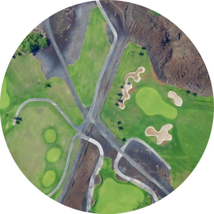
Explore High-Resolution Imagery

We’ll capture your property in immaculate detail with high-resolution aerial imagery and 10-band multispectral
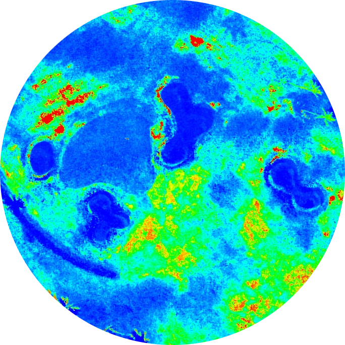
Monitor Turf Health

Catch problems early with plant health indices like NDVI and GNDVI
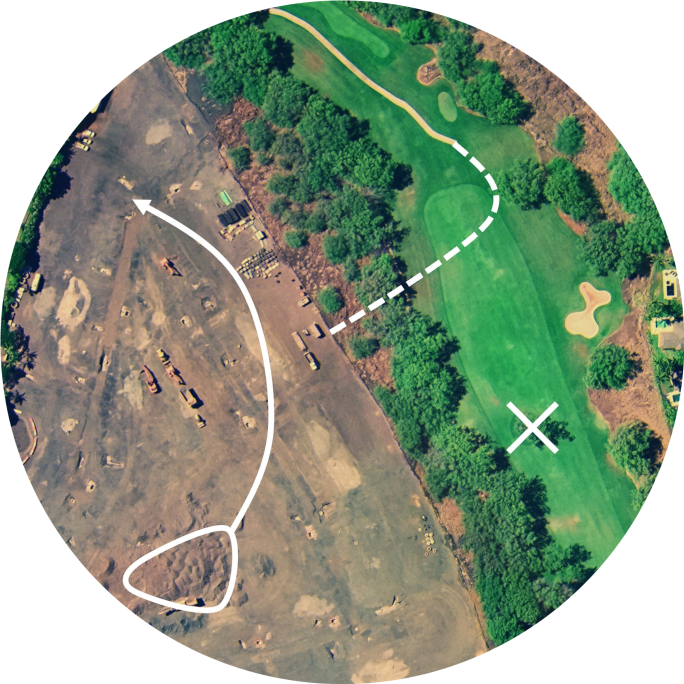
Plan Construction & Renovation

Get survey-grade maps, models, and contour lines to help you plan your next project
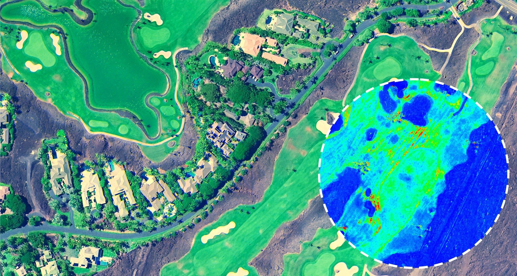
Large aerial golf course survey imagery with a cutout showing the same areas in NDVI, which indicates turfgrass health.

Plant Health Indices

Quickly identify trouble areas with plant health indices (blue: unhealthy, green to red: healthy)

Get a bird’s eye view within days

  • Receive high-resolution multispectral maps of your entire property in a matter of days, not weeks

  • Uncover deeper insights with 10-band multispectral imaging and plant health indices

  • Aerial data capture can take as little as half an hour, minimizing disruption to players 

Get a Quote

See your property like never before

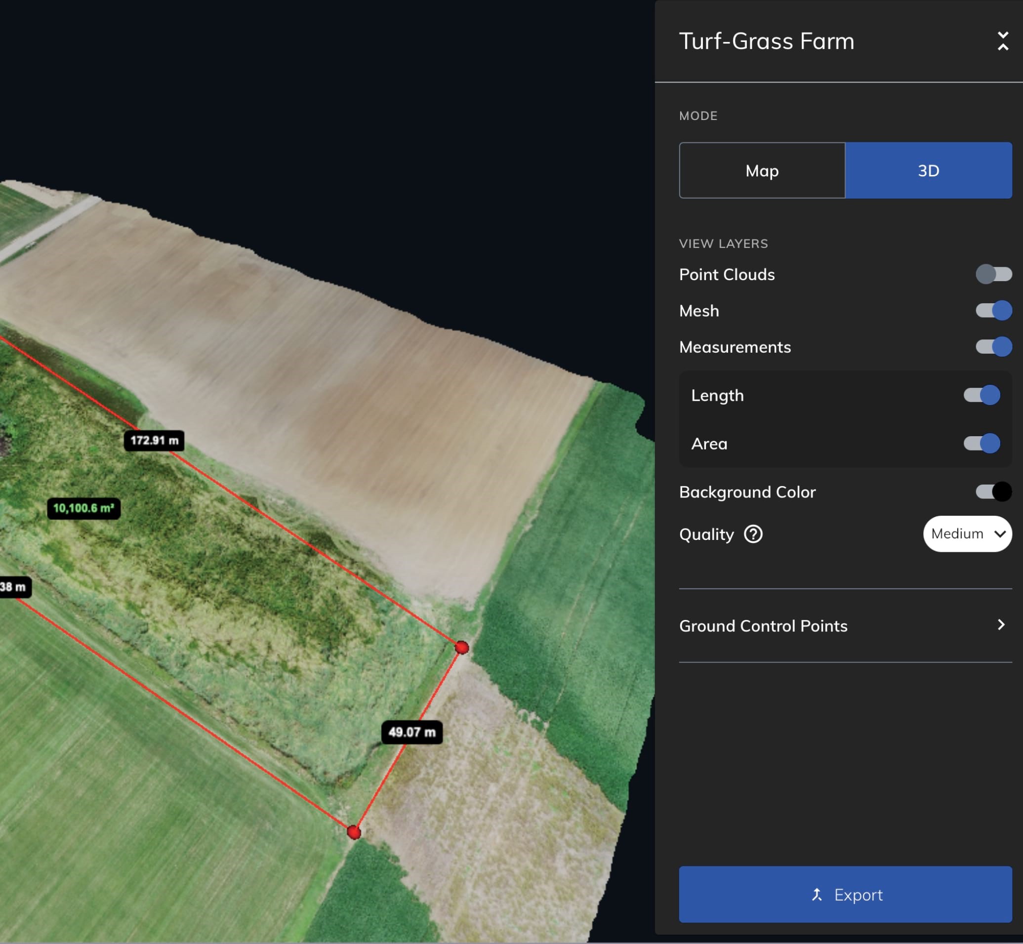
  • Explore maps and 3D models of your property at any time from your standard web browser

  • Keep track of damage, weeds, herbicide applications, and more in Mapware 

  • Share high-resolution maps with stakeholders in just a few clicks
Get a Quote

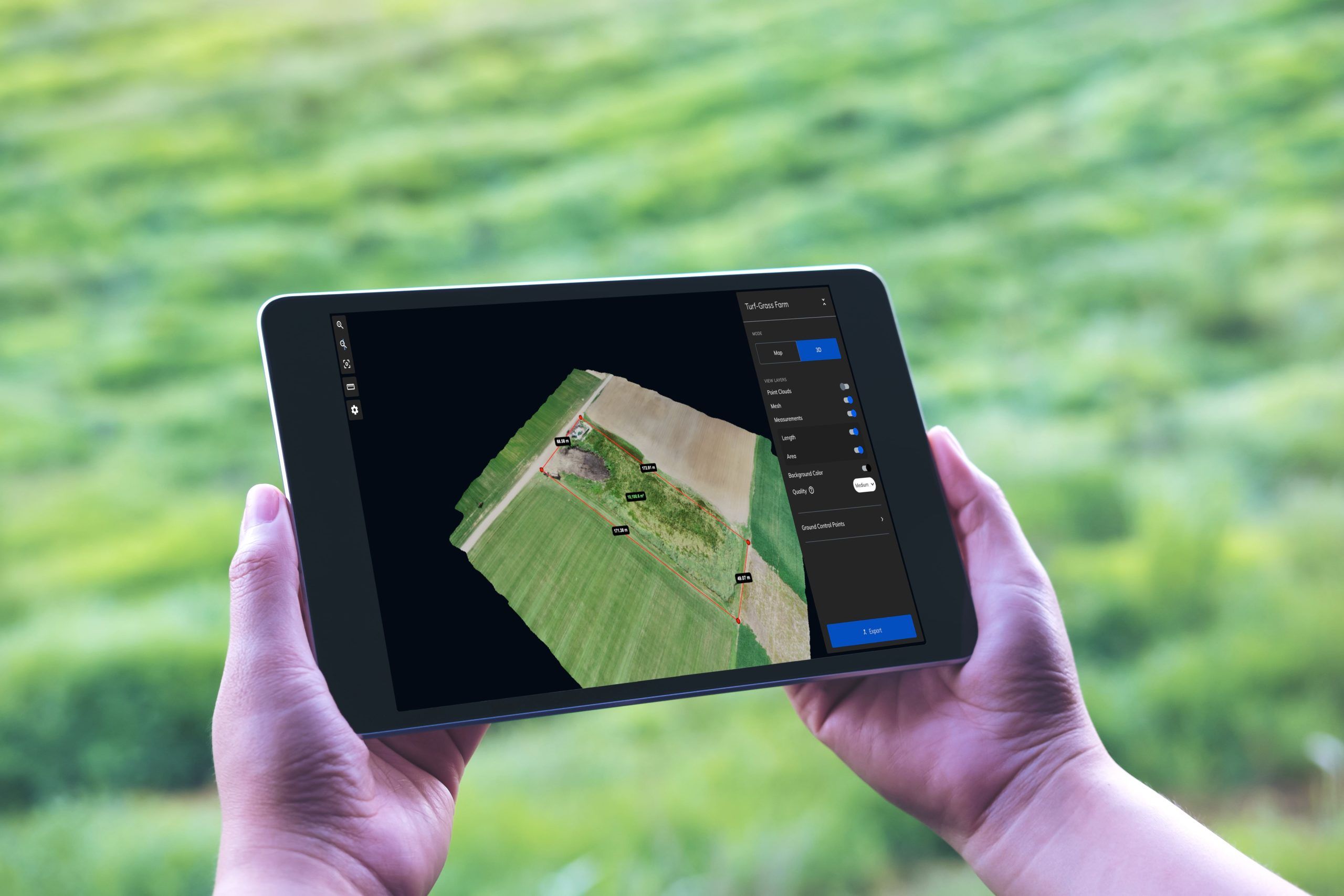
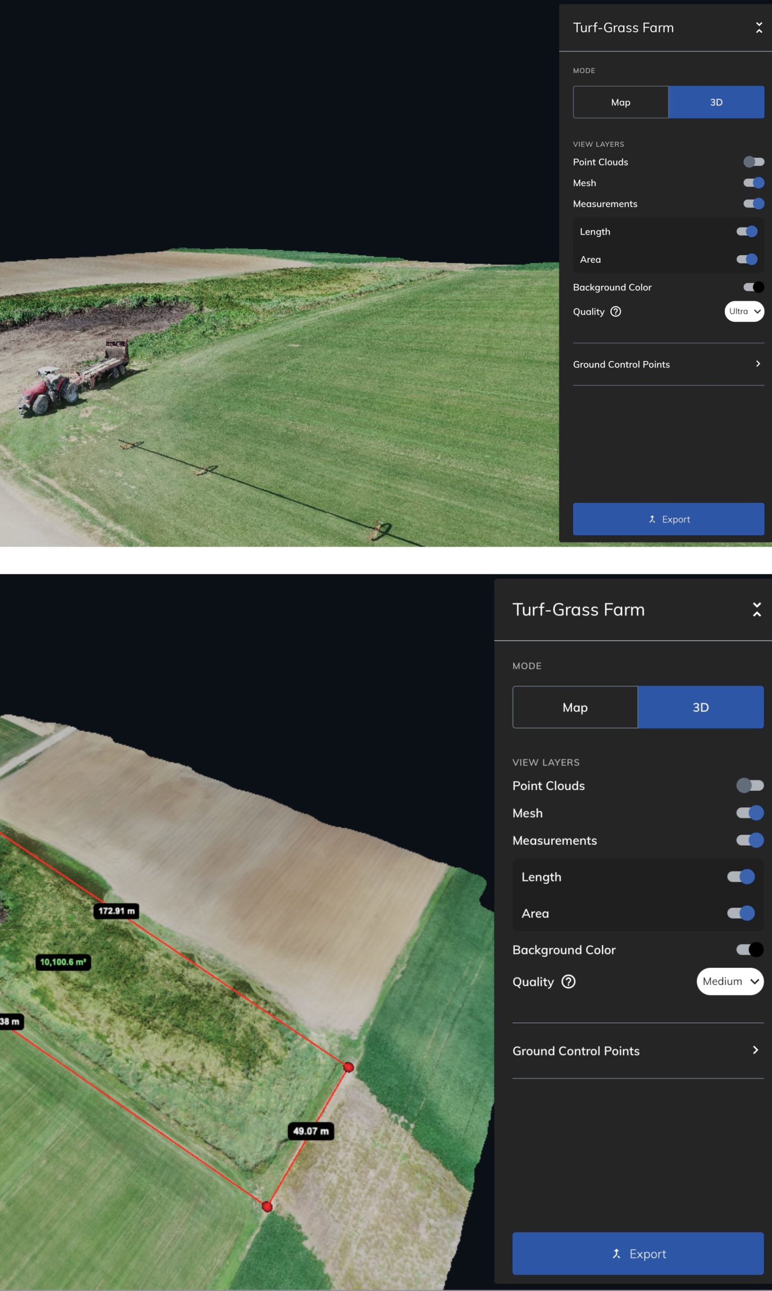
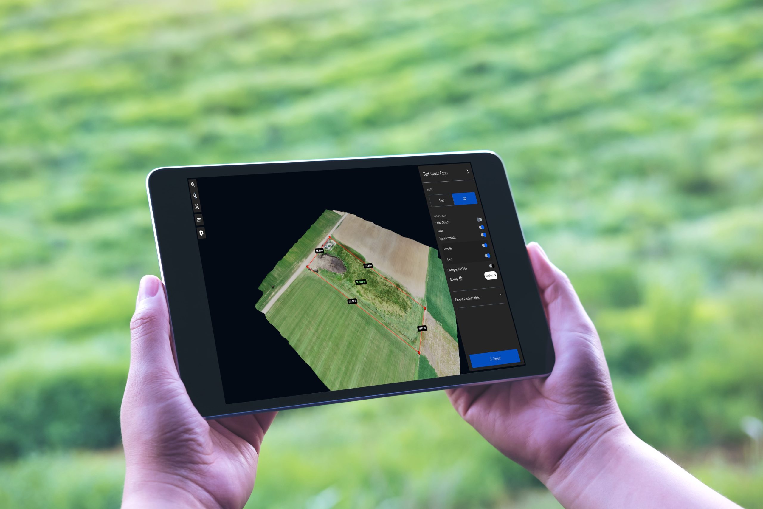
A screenshot of the Mapware platform showing an aerial turf inspection in 3D

Better planning starts with better data

Get a Quote

  • Orthomosaics, point clouds, and 3D models

  • 10-band multispectral

  • Plant health indices

  • LiDAR

  • Thermal imagery

  • Contour lines

  • Digital elevation models & topographic surfaces

  • Cut/fill

  • Custom AI solutions

Mapware is exhibiting at Booth #66 of the GCSAA Conference and Trade Show

Visit us at GCSAA 2024

Want to learn more about how you can transform golf course management with Mapware?

Meet our friendly team of experts at the 2024 Golf Course Superintendents Association of America Conference from January 29 – February 1.

Visit us at Booth #66!

Find Our Booth

More data, more possibilities

Aerial surveying can make a big impact on golf course operations. Total visibility enables a range of new insights that can save time and money at dynamic golf properties. 

Ready to explore the possibilities?

Learn about applications for aerial surveying in our free solution brief.
Get Free Guide

Mapware is exhibiting at Booth #66 of the GCSAA Conference and Trade Show

Ready to learn more?

Our team of US-based experts is more than happy to chat about your specific needs.

Contact Us

Continue reading

Mapware for Government

Mapware for Government

Drone mapping, data, and insights built for the federal, state, and local sectors.

Contact us to learn more

Drone mapping for the most demanding situations

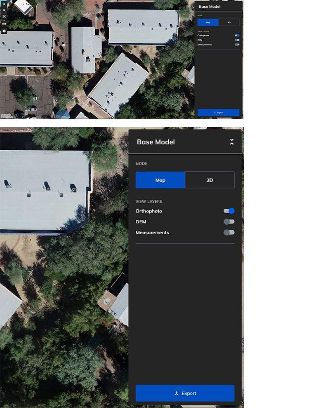
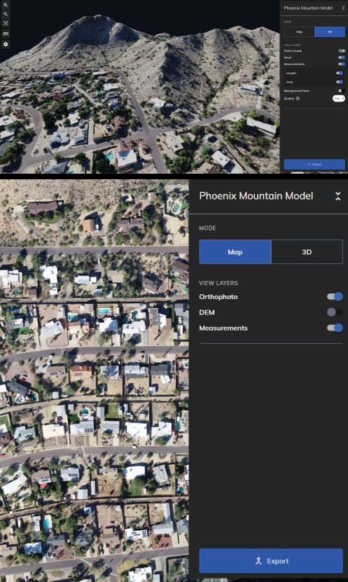
Easily turn aerial photographs into high-resolution 3D models, orthomosaics, and digital elevation models.

Mapware is a fully US-based, secure platform ready to meet the needs of government customers.

Rapid, actionable insights for your unique mission

  • Commercial Property
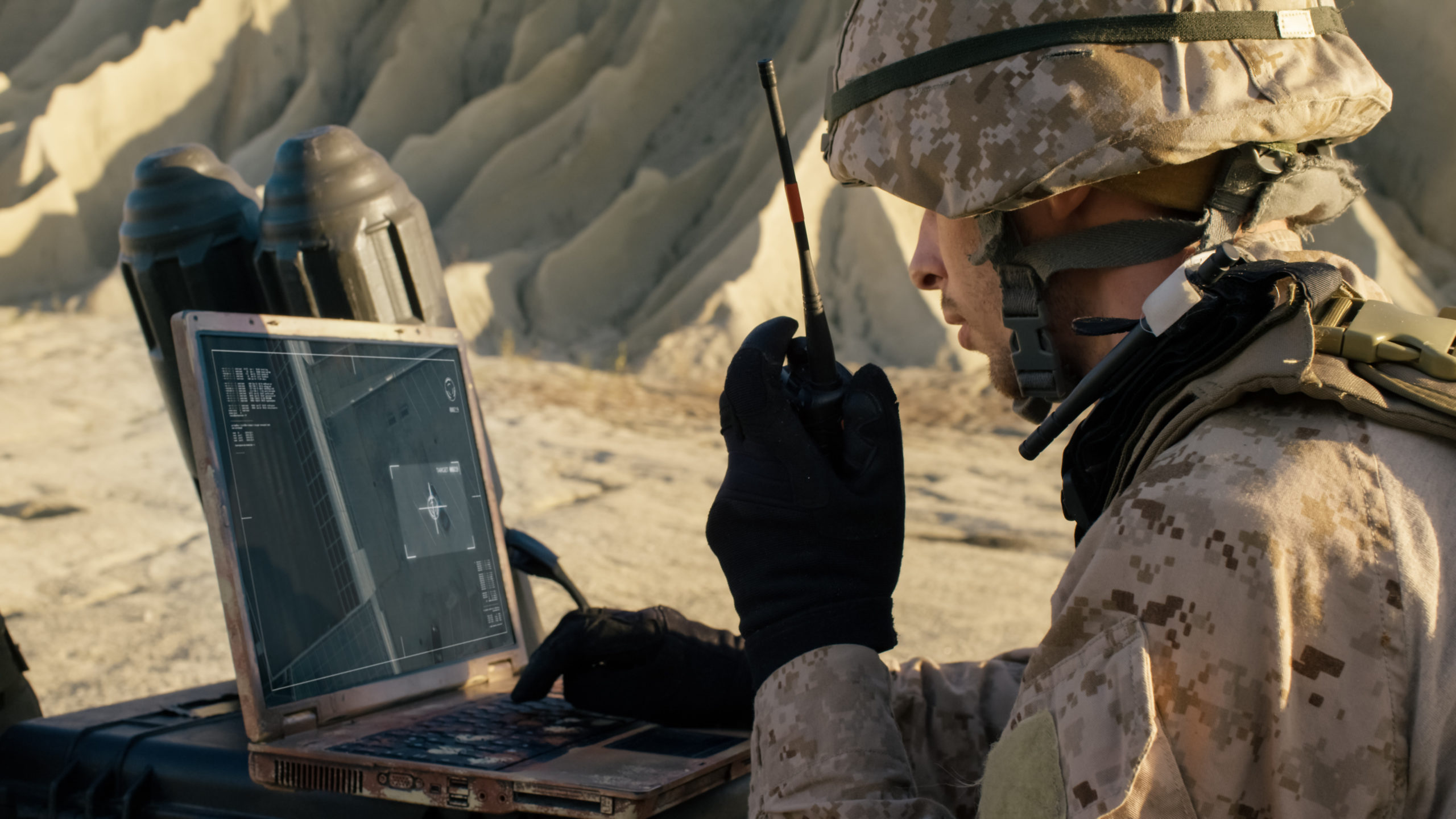
    Defense
  • Construction and Inspection
  • Automotive
    Environmental Monitoring

A proven tool for geospatial intelligence

  • Securely built with the public sector in mind

  • Works on any device with an internet connection

  • Deployable on all secure cloud services

  • Intuitive and easy to use with minimal training

  • Easily and securely collaborate and share maps with key stakeholders

  • Customizable options built for your organization. Contact us for AI/ML solutions, tailored integrations, and custom deployments

Perform low-cost, high-fidelity inspections

Learn more about our work with the US Air Force

“Mapware has been a fantastic and talented partner and are well positioned to deliver this advanced drone imagery and machine learning capability for multiple installation and mission support enterprise uses.”

Former AFIMSC Chief Innovation Officer Marc Vandeveer 

Read the Blog Post

Complete geospatial intelligence solutions for America’s most critical missions

  • A proven provider for the US Government

    Mapware provides advanced geospatial intelligence solutions for the US Air Force and the US Army Corps of Engineers.

  • Based in the United States

    Get a fully American solution to your geospatial needs. Our cloud hosting, engineering, program management, and technical support are all based in the United States.

  • Adaptable solutions built with you in mind

    Take advantage of tailored solutions, including custom deployments, integrations, and AI/ML-powered analytics.
    Contact us for more information.

Let’s Chat!

Discover how we can solve your biggest mapping challenges.

contact us

Continue reading

Mapware for Drone Operators

Mapware for
Drone Operators

Mapware puts high-quality maps and models at your fingertips—whether you’re a photogrammetry pro or a first-time user.

Get Started Free

Reach new heights with your drone business

Mapware’s easy-to-use technology is a great, low-risk option for any drone business. Mapware offers:

  • A streamlined user interface that’s easy to learn

  • Straightforward and intuitive project storage

  • Simple, flexible pricing options

  • Cloud storage included on every plan

Get Started Free

Create high-quality photogrammetry products right away

Mapware’s streamlined, no-fuss interface makes getting started easy. Create 3D models, digital elevation models (DEMs), and orthomosaics with just a few clicks. That means your pilots can focus on flying, not on user documentation and training.

Just getting started flying drones? Download our free guidebook to learn more about creating high-quality models.

Get Free Guide

Perform low-cost, high-fidelity inspections Maintain trusted records


Export formats

Dense point cloud (.las)
Digital Elevation Model (.tiff)
Orthomosaic (.tiff)
Mesh and texture (.obj)

No need to buy
new equipment

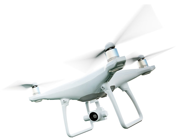
  • Mapware works with any camera drone.

  • Run Mapware from your laptop, tablet, or smartphone—all you need is an internet connection and a web browser.

  • Our cloud-based platform takes the burden off your machine. With GPU-accelerated processing, Mapware quickly produces high-resolution models.

  • Mapware will slot right into your existing workflow. Get in touch to learn about our support for custom software integrations.

Get Started Free

Safeguard your data

  • Mapware is a powerful system of record for your raw drone photos, photogrammetry products, and more.

  • Mapware securely stores your models for as long as you want, at no extra cost. Check back in a year or a decade—Mapware will still show your valuable data.

  • Mapware is fully US-based, including our software, cloud storage, engineering, program management, and technical support.

  • Working for the US government? Contact us for deployment on our secure government cloud platform.

Get Started Free


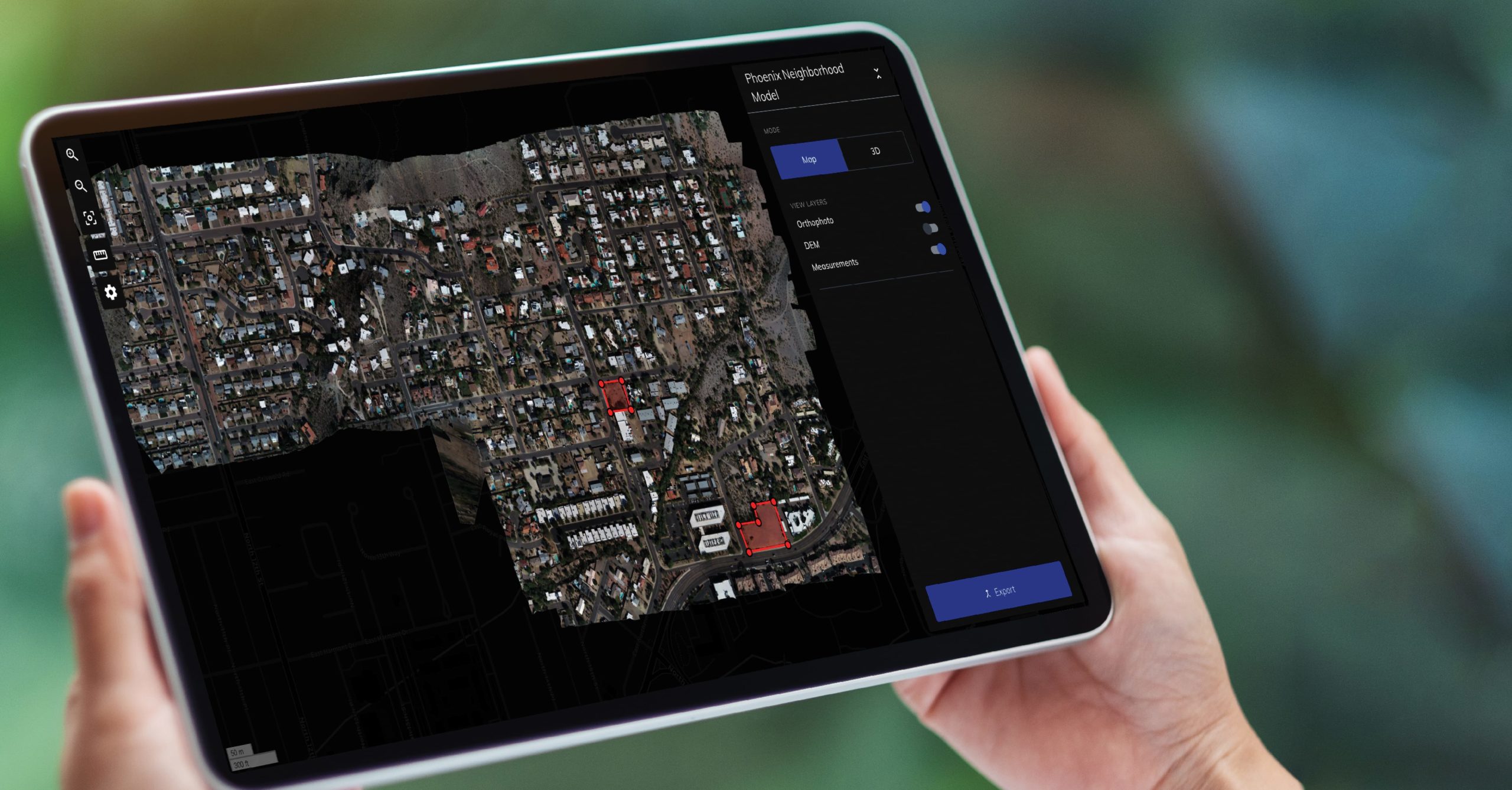
Mapware on a tablet

Simple, flexible pricing

Whether you’re new to drone mapping or a veteran pilot, our subscription options are designed to give you exactly what you need.

With Mapware, you’ll get the enterprise experience without the high upfront investment. Mapware’s cloud storage, super-fast processing, unlimited GCPs, and more are included at every pricing tier.

Learn More

What’s included?

  • Unlimited images per map, exports, and GCPs
  • Cloud storage
  • Fast, GPU-powered processing
  • Access from any number of devices (desktop or mobile)
  • Suite of measurement tools

Try out Mapware’s powerful photogrammetry software with a free trial account.

start now

Continue reading

Mapware for Agriculture

Mapware for Agriculture

Mapware makes it easy to grow your agricultural business with drones. Simplify inspections and make smarter planting decisions with Mapware’s easy-to-use tools.

Get Started Free

Precision agriculture within reach

With Mapware’s powerful suite of tools for drone mapping, any farm or ranch can adopt cutting-edge precision agriculture techniques. 

Mapware’s flexible subscriptions and no-extra-cost cloud storage are designed to grow with your needs.

Get Started Free

Inspect, understand and plan

  • Use high-res maps to plan your next action, whether it’s deciding how much fertilizer to order or building a new greenhouse.

  • Plan irrigation and planting with drone maps of your fields—no need for a costly manual survey.

  • Measure your land, infrastructure, feed, supplies, and more with Mapware’s suite of measurement tools.

  • Quickly assess weather, fire, or other damage without putting your personnel at risk. With Mapware’s fast processing, you can kick off recovery efforts and submit insurance claims soon after the damage is done.

Get Started Free

Perform low-cost, high-fidelity inspections Maintain trusted records

Store and share maps

  • Mapware stores your models for as long as you want, at no extra cost. Check back in a year or a decade—Mapware will still show your valuable data.

  • Track erosion, new construction, irrigation changes, and more. Mapware makes it easy to organize your models to drive data-informed decisions.

  • Make sure your whole team is on the same page. With Mapware, you can easily share your models with stakeholders, organized into teams with access levels that support your workflow. 

  • Mapware offers a variety of export formats so you can bring your point clouds, digital elevation models (DEMs), orthomosaics, and meshes into the next stage of your workflow.

Get Started Free

Simple and easy to use on any device

  • Mapware’s streamlined, no-fuss user interface makes it easy to get started.

  • Whether you’re at a desk or out in the field, Mapware will show you a detailed, bird’s-eye view of your land. Mapware works on any device with an internet connection, including tablets and phones.

  • No need to download any new software—use Mapware with your standard internet browser.

Get Started Free

Simple, flexible pricing

Whether you’re new to drone mapping or a veteran pilot, our subscription options are designed to give you exactly what you need to start using drones to grow your agriculture business.

With Mapware, you’ll get the enterprise experience without the high upfront investment. Mapware’s cloud storage, super-fast processing, unlimited GCPs, and more are included at every pricing tier.

Learn More

What’s included?

  • Unlimited images per map, exports, and GCPs
  • Cloud storage
  • Fast, GPU-powered processing
  • Access from any number of devices (desktop or mobile)
  • Suite of measurement tools

Try out Mapware’s powerful photogrammetry software with a free trial account.

start now

Continue reading