Month: September 2022

How Drones Are Transforming the AEC Industry

Just as advancements in computer-aided design (CAD) technology have made it possible for architects and engineers to produce more accurate drawings more efficiently, the evolution of drone technology is also changing the landscape of the architecture, engineering, and construction (AEC) industry. The ability to capture and analyze 2D and 3D imagery and videos has the potential to positively impact every step of the design and construction processes.

Drone Use in the AEC Industry

The commercial drone market is on the rise in large part because of demand in the construction industry. According to Expert Market Research, this is because of drones’ “ability to survey land, provide continuous and precise project notifications, improve safety, and prevent dangerous incidents on construction sites.”

Let’s take a look at some of the ways drones are transforming the AEC industry.

Architecture

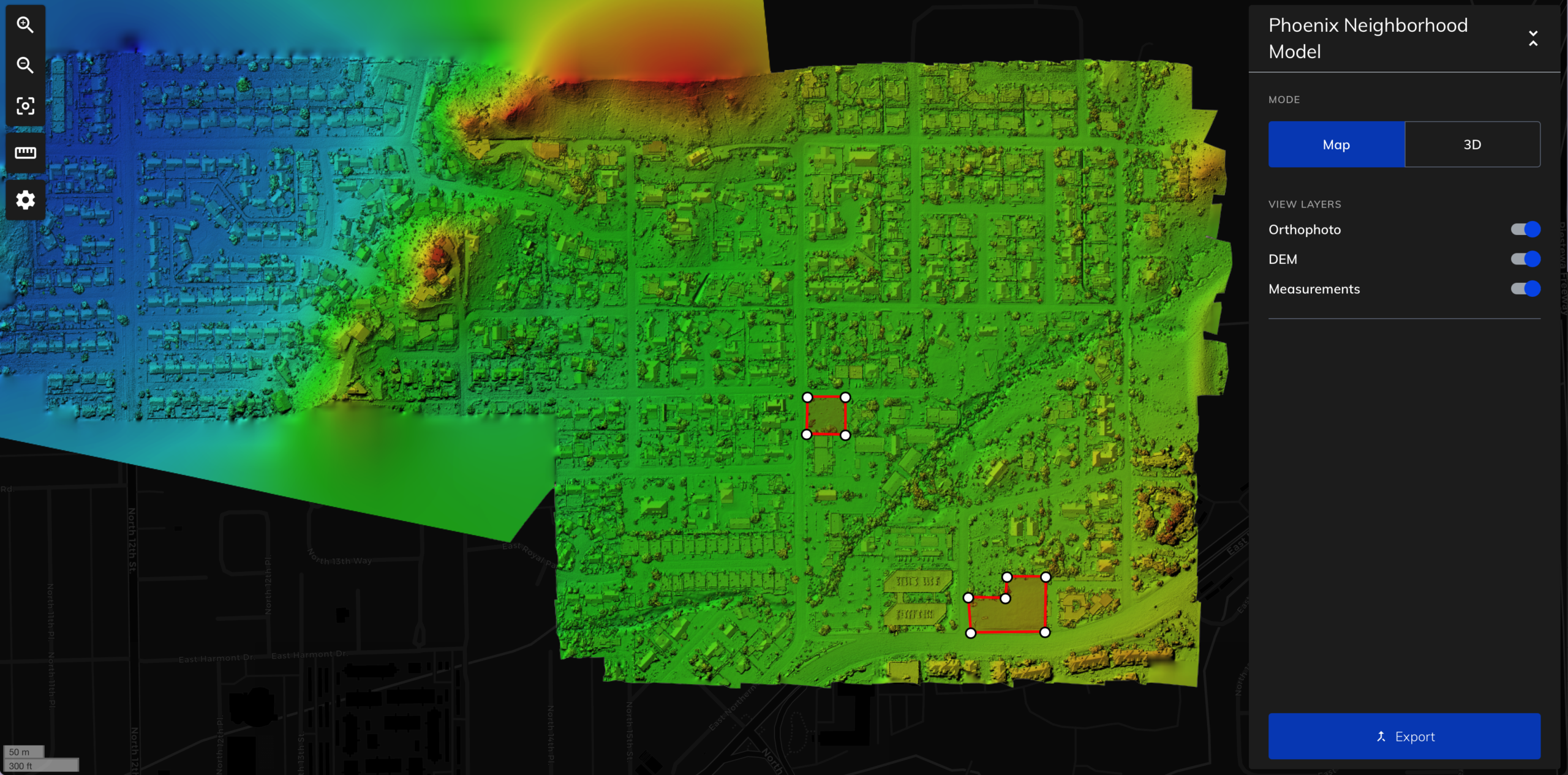
Using drones to survey land gives architects the information they need to determine the most appropriate building siting and orientation. Accurately establishing the locations of other structures, trees, utility infrastructure, and other potential obstacles is essential in the early phases of design. In later phases of design, photos can be incorporated into drawings and renderings to show what the building will look like on the actual site.

Engineering

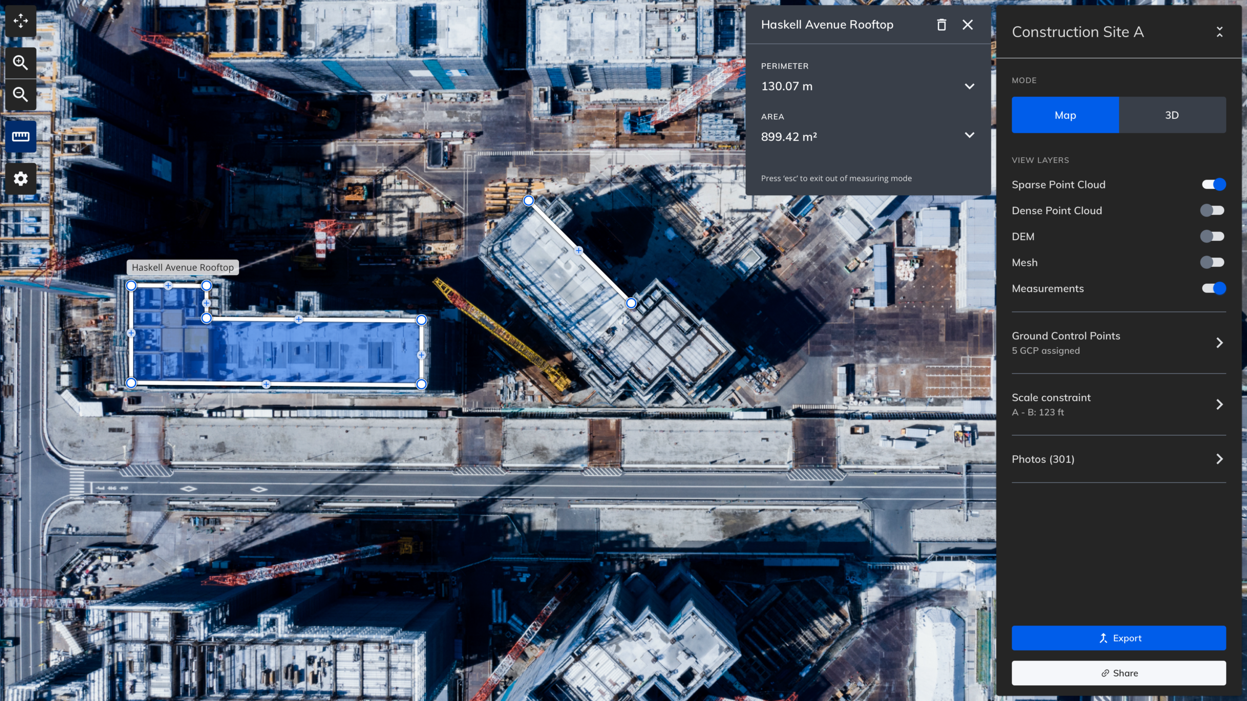
Engineers use drone imagery to monitor project progress and generate as-built 3D models and 2D elevations. Comparing as-builts to engineering drawings helps ensure that structural elements are located in the right places before construction continues. Additionally, thermal imaging can be used to find heat leaks and other issues throughout the building process. Engineers are also able to safely and efficiently perform inspections without cranes, the associated labor, and the accompanying risks involved. 
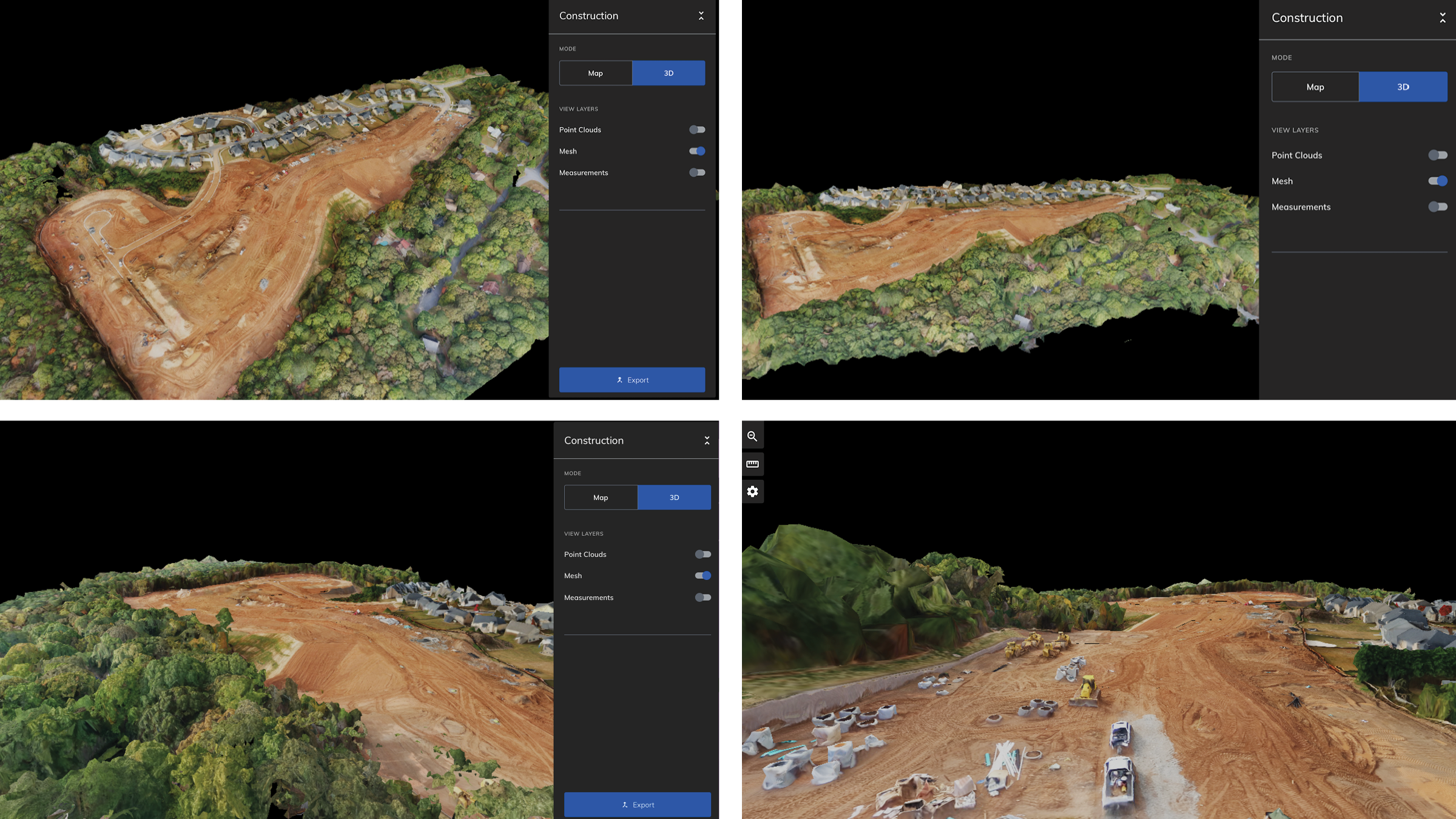
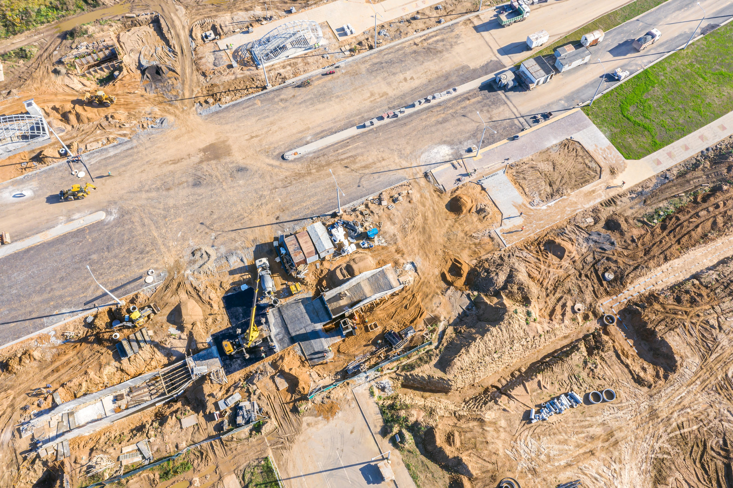
Construction

Getting site images through the use of drones helps improve the estimation and bidding process because contractors can determine the scope of site and access work that needs to be completed. Once construction has started, visual inspection of drone imagery helps prevent theft of materials and equipment and improves safety with hazard identification. 

In addition to photos taken from the ground, drones also provide cost-effective recordkeeping for project stakeholders and insurance purposes throughout the duration of the project. In some cases, drones might also be used to transport materials to the site with minimal disruption to the environment. 

Real-World Examples of Drone Use in the AEC Industry

Drones have been used in the AEC industry to determine the scope of infrastructure damage in the aftermath of natural disasters. Identifying the damage as quickly as possible is one of the first steps to recovery. Comcast and Mapware have worked together to identify and prioritize physical infrastructure damage after hurricanes, resulting in improvements in safety and response times.

Other Mapware users have used drones for:

  • 3D mapping the location of a new warehouse located on the other side of the country and making live data available to project stakeholders
  • Remote site and building surveys—including of difficult-to-measure areas—without having to go back to the site
  • Affordably creating large, combined models for overseas civil engineering projects 

Benefits of Using Drones in the AEC Industry

As the technology continues to permeate the AEC industry, many professionals are discovering the benefits of incorporating drones at every stage of a project.

Efficiency

Drones allow you to map sites in a fraction of the time compared to traditional surveying techniques. Get faster access to difficult-to-reach sites and quickly share data with the people who need it. 

Accuracy

Ground control points and photogrammetry deliver more accurate results than ground measurements performed by humans. Reduce costly mistakes and eliminate the need for multiple site visits.

Elements that can help with accuracy include:

  • Mission types and flight planning to capture images that align with your goals
  • Ground control points to establish known coordinates
  • GPS corrections to adjust data and get accuracy to the centimeter
  • Map measurements

Reduced Labor

Performing inspections remotely reduces the number of people needed on-site and the time required from the team to complete them.

Automation

Automate and plan flights to capture pre-project conditions using only your drone and tablet.

Cost Savings

Build projects faster with fewer resources by getting design and construction surveys more quickly and efficiently. Increase productivity and time to execution with exceptionally accurate data and models.

Collaboration

Easily share 3D models and measurements with clients prior to project kickoff. Keep stakeholders informed of project progress from beginning to end, no matter where they are located.

Transparency

Monitor the full construction lifecycle for transparency and accuracy.

Risk Avoidance

Proactively identify and manage potential risks and irregularities before they occur and enhance team safety by employing unmanned aerial vehicles (UAVs) to manage tasks.

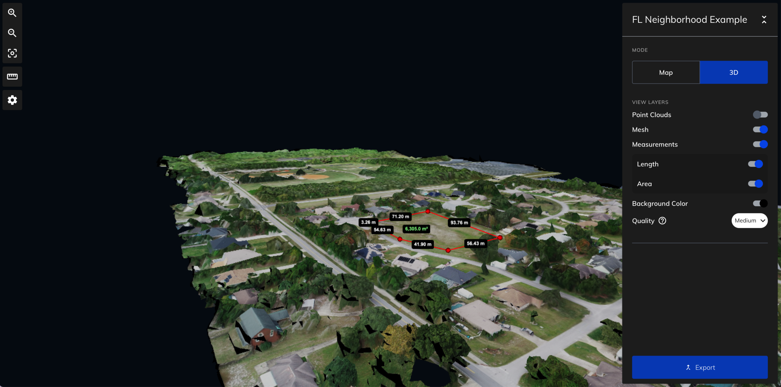
Get Started with Mapware

Mapware provides drone mapping solutions to support AEC projects of any scale and scope. From the initial survey to verifying as-builts to capturing marketing videos of completed projects, drones deliver benefits at every stage of a construction project. 
If you’re interested in exploring how Mapware can support your next design or construction project, reach out to our team to request a demo.

Give Mapware a try today with our 15-day free trial.

Mapware Listed as a Leader in Photogrammetry on the #1 Independent Software Review Site – G2

Mapware is proud to be listed as a leader in Photogrammetry on G2. We are one of the three Photogrammetry solutions (out of 40 total listings) included in G2’s Grid that have been recognized by G2’s unique methodology, which evaluates thousands of programs based on specific criteria such as ease-of-use, customer support, and user satisfaction.

Our customers have spoken

This is an exciting achievement, as we continue to work hard to develop a tool that serves the incredible photogrammetrists and Geospatial Intelligence professionals of the world and helps make their jobs easier.

Customers on G2 have recognized Mapware for its speed, ease of use and support. They also reinforce our dedication to build a tool that serves our customer’s needs and helps make the global mapping experience more enjoyable and effective.

We’re excited about this recognition from G2, but even more so because it means we get to keep doing what we love – helping people create innovative 3D maps!

Mapware reviews sourced by G2

Of the thousands of products evaluated using G2’s unique methodology, only the top-performing products are recognized in a quadrant

Mapware is one of two photogrammetry solutions to be listed as a leader by G2 (right alongside Esri), the world’s largest independent software review site. This recognition is based on our innovative photogrammetry tools, user experience and data from real users who have rated five stars.

To evaluate which products, deserve this designation G2 reports “G2 scores products and sellers based on reviews gathered from our user community, as well as data aggregated from online sources and social networks. Together, these scores are mapped on our proprietary G2 Grid®, which you can use to compare products, streamline the buying process, and quickly identify the best products based on the experiences of your peers.”

We are appreciative to all the photogrammetrists and 3D mapping professionals who used and reviewed Mapware and are excited to keep improving our tool to ensure customers keep having outstanding experiences.

Conclusion

We are proud to be a leader in the Photogrammetry quadrant and look forward to this path of innovation as we continue to develop and release new features that will make your photogrammetry and data collection process easier than ever before! Have some thoughts about your experience with Mapware that you’d like to share? Submit a review here!

Construction Surveying & the Future of Engineering

In the past, construction surveying has required sending teams of people to sites to gather and synthesize information. In recent years, technological innovation has changed the way professionals approach this essential step in the construction process.

Discover how to leverage drone technology for construction surveying needs to save time and money while improving worker safety. 

Elements of Construction Surveying

Whether it’s a small house or multi-acre industrial complex, one of the first steps in any construction project is getting the lay of the land for planning, permitting, design, and construction.

Mapping

Mapping helps designers and engineers understand property lines and other important boundaries so they can comply with zoning and other regulations. This step is also essential for creating a legal description of the property, which is used in real estate documentation.

Topography

Capturing the topography of a site allows you to understand where human-made and natural features of the property are located and how they relate to each other. From this information, you can:

  • Identify areas where earth must be moved and leveled.
  • Establish possible building sites.
  • Determine the most efficient strategy for site access.
  • Calculate estimated costs for grading based on how much fill will be required.

Construction Layout

Surveying data is used in the design process to determine where a building will be positioned on the site and how it will be oriented to optimize solar gain, views, and other factors. This data is also used to develop engineering drawings that show the specifications for load-bearing piles and other foundational elements, which depend on accurate geotechnical information.

Staking

Prior to construction, the site is staked out with the exact location of buildings. Construction surveys are used to verify the accuracy of stake locations by comparing them to engineering drawings. 

Technological Advances in Construction Surveying

In its infancy, construction surveying required using physical objects to measure both vertical and horizontal distances. As the technology evolved, total stations and other tools were developed to measure distance, elevations, and angles electronically, then eventually with remote and robotic technology. In more recent decades, the combination of GPS and drone technology has further advanced construction surveying with even more automation.

Remote Surveying

Remote construction surveying with a drone allows you to quickly and efficiently gather existing conditions in both 2D and 3D. For planning purposes, you can learn about:

  • Terrain details and vegetation that might impact site access
  • Utility infrastructure to work around
  • Topology of the site
  • Existing exterior conditions for renovation projects

With high-resolution 3D information, you can provide key measurements to concrete subcontractors, determine which equipment is necessary for reaching certain areas, and more. 

Some of the benefits of using drone surveying technology include:

Saved Time

Get faster, more accurate results than with manual surveying methods. Flying a drone is much quicker than sending people into the field to survey a potential building site, and there is less room for error. 

Saved Money

Why incur the costs of heavy-duty vehicles and cranes when you can access a construction site remotely? Flying a drone is a much more cost-effective solution than renting machinery or a plane. 

Improved Safety

Did you know that falling is one of the leading causes of death for construction workers? Although it’s not possible to eliminate all the work that must be done at potentially hazardous heights, using drones to capture imagery reduces risks and helps protect workers. 

Reduced Labor

In many cases, a team of two can gather all of the information that previously required larger teams, including equipment operators.

Reduced Impact

Remote sites with challenging access can be difficult to survey. You may need to comply with environmental regulations just to get to the site for measurements. Flying a drone to gather the data you need bypasses all of this.

Project Monitoring

When a project is under construction, a bird’s-eye view of the site can be invaluable. Capture daily, weekly, or monthly images and videos for recordkeeping, future training purposes, or in the worst-case scenario, for insurance investigations. Using drones throughout a construction project is a great way to show progress to stakeholders no matter where they are located. 

Compare as-built imagery to design and engineering drawings to detect and correct flaws before they become more problematic. Validate compliance with project requirements such as regulatory, environmental, zoning, and so on. Use drone footage at various construction project milestones as part of quality inspections and save money on cranes and the labor associated with using them. 

Visual inspection of drone imagery also allows you to identify hazards, so you can stop accidents before they happen. You can also accurately measure the amounts of materials on-site to ensure you have what you need when you need it. 

An aerial top down view of a road construction site with machinery in operation

Try Construction Surveying with Mapware

The future of engineering is intertwined with technological advances in drones and photogrammetry. If you’re not at least evaluating the potential benefits of remote construction surveying, you will fall behind in the industry. Using a tool such as Mapware allows you to get all of the construction surveying information you need, often with better quality and more efficiency than traditional methods.

With Mapware, you can get accurate, detailed information at every step of a construction project lifecycle. Make a flight plan before you go into the field to capture site data. Create automatic flight paths for weekly monitoring while a project is under construction. Use advanced photogrammetry features and 3D modeling to capture as-built details, measure materials on-site, and much more.  

Start a 15-day free trial for Mapware today.