How Are Digital Elevation Models Created?

Sometimes you need to understand the topography of an area without the surface objects such as trees, buildings, and other vegetation and structures. The old way of getting this information was through topographic maps, which can be difficult to interpret. Now that drones can capture actual topographic footage, it’s possible to get current imagery and digitally manipulate it in three dimensions. This is where digital elevation models come in.
What Are Digital Elevation Models?
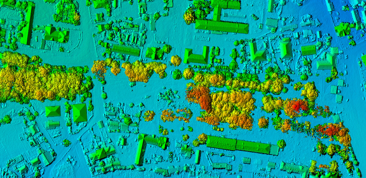
A digital elevation model (DEM) is a topographic data set that displays only geological features on the ground, underwater, or both. This information can be used to create maps that can be viewed in two or three dimensions. The data is stored in a raster file with geographic metadata that enables accurate location and measurement of distances and elevations.
How Do I Create a Digital Elevation Model?
Although it’s possible to create a DEMs through ground surveying techniques, this method is extremely time-consuming and requires specialized equipment and expertise. Modern methods for creating digital elevation models include the following.
Aerial Photogrammetry
Images captured from satellites, planes, helicopters, or drones can be used to create 3D models with photographs and DEMs using visual and infrared imagery. The images are processed with photogrammetry software to deliver digital models.
Because they can fly much lower and are less likely to be impacted by weather conditions, drones are the most versatile option. They are also much less expensive to deploy and require fewer resources overall.
Radar Interferometry
Elevation data can be measured using radar interferometry, which has the beneficial ability to capture information in darkness and bad weather with the use of electromagnetic signals reflected from the earth’s surface. Satellites or airplanes are required for this digital elevation model technique; however, it provides highly accurate data, in some cases within centimeters.
Multibeam Echo Sounders
For underwater digital elevation models, topography is measured using sound. An echo sounder mounted on a watercraft or autonomous underwater vehicle sends pulses of sound waves into the water. The time it takes for the waves to return indicates the depth. Accuracy ranges from centimeters to meters, depending on the technology used.
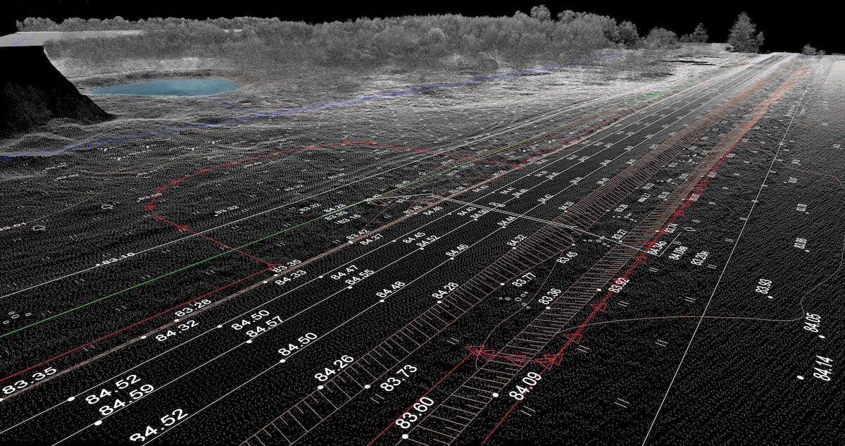
Light Detection and Ranging (LiDAR)
A laser altimeter on a drone, plane, or satellite emits lasers that sweep from side to side and start a counter. The light reflected back causes the altimeter to stop counting, which creates a dataset that allows the distance to be calculated. The data is processed to create a continuous raster that can be used to create a topographic map.
How Are Digital Elevation Models Used?
DEMs are used by a broad range of industries for various applications. Some examples include:
- Modeling landslides to see how the landscape has changed and identify potential risks
- Creating physical 3D models
- Analyzing terrain for oil and gas exploration
- Agricultural research and soil science
- Monitoring habitats of endangered species
These are just a few examples of the many ways digital elevation models might be used by local and regional governments, academia, insurance companies, construction companies, and more.
Digital Elevation Models with Mapware
Mapware makes it easy to create digital elevation models in high-resolution TIFF files of imagery captured with drones and processed with our photogrammetry software. The DEM layer can also be interposed with an orthophoto layer to see the real-world imagery and a measurements layer. With its intuitive interface, reliable platform, and integrated collaboration tools, Mapware is the digital elevation model program of choice in industries of all types.
To learn more about real-world applications for drones and photogrammetry, read How the Public Sector Uses Geospatial Intelligence and Data-Driven Mapping.