Archives
- July 2023
- June 2023
- May 2023
- April 2023
- March 2023
- February 2023
- January 2023
- December 2022
- November 2022
- October 2022
- September 2022
- May 2022
- April 2022
- March 2022
- February 2022
- January 2022
- November 2021
- October 2021
- March 2021
- July 2020
- May 2020
- April 2020
- March 2020
- December 2019
- October 2019
- September 2019
- June 2019
- May 2019
- April 2019
- September 2018
- June 2018
The Aerial Perspective Blog
Mapware Is Helping the U.S. Air Force Protect Endangered Birds

A bird on the brink of extinction could benefit from advanced software that helps the U.S. Air Force monitor forests, tree health, and golden-cheeked warbler habitat. How can UAV technology help this native Texas bird thrive?
The golden-cheeked warbler, a bird known for the bright plumage on its face and a black stripe near its eye, only breeds in one place in the world: approximately 39 counties in central Texas near the Edwards Plateau.
These colorful native Texas birds make homes in stands of trees with of a mix of drought-hardy evergreen Ashe junipers and Texas hardwoods, peeling the unique strippable bark from the mature Ashe juniper to build their nests during breeding season.

A dwindling habitat
But habitat destruction and fragmentation due to urban sprawl in the fast-growing state of Texas, along with parasites and cow birds invading their habitat, has kept the golden-cheeked warbler on the list of endangered species for nearly 30 years.
Without intervention to preserve lands where Ashe juniper trees grow, the bird is at risk, with dangerously dwindling numbers: Audubon estimates there are only about 27,000 birds left.

Bringing them back from the brink
Managing endangered species habitats in Texas Hill Country is on the agenda for the Camp Bullis Military Training Reservation, which encompasses 27,990 acres northwest of San Antonio, not far from the Balcones Canyonland Wildlife Preserve.
There, Ashe juniper trees grow among deciduous Texas oak, black walnut, pecan, sycamore, and hackberry trees. Forests with the right ratio of deciduous hardwood and mature Ashe juniper trees provide ideal habitat for the golden-cheeked warbler.
To protect the bird’s habitat, the U.S. Air Force needed a solution that could assess the forest canopy, tree distribution, tree type, tree class, and ratio of one type of tree to another. Imagery gathered from unmanned aerial vehicles (UAVs), or drones, proved a good place to start.

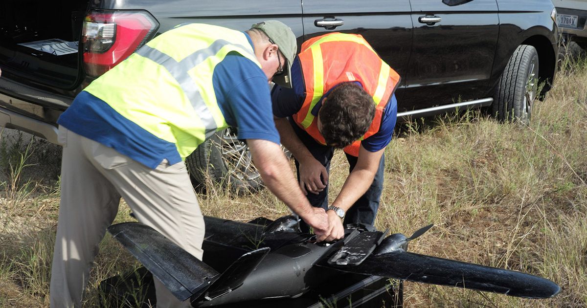
(Credit: Tony Roman ©Mapware)
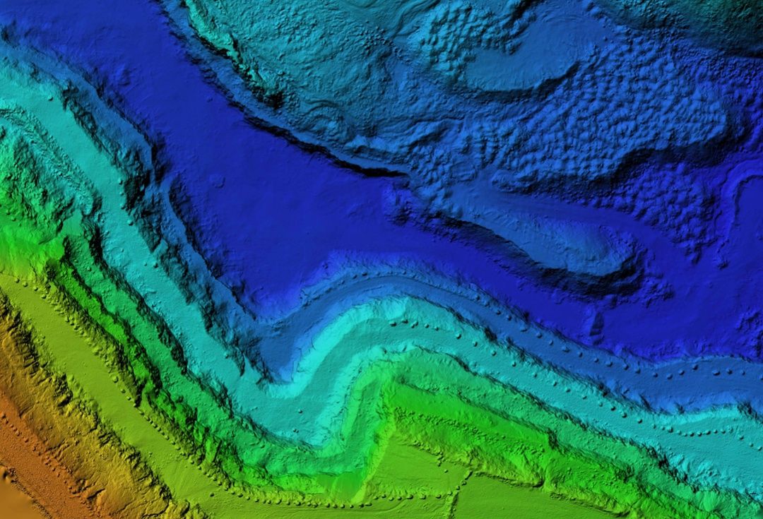
In September, Mapware flew several drone flights over 400 acres at Camp Bullis, capturing natural color and multispectral image data. When this aerial data is combined with multiple sources of geolocated data like digital elevation models, LiDAR, and infrared data, it creates information-rich data sets about the Camp Bullis site.
The result is a powerful tool for determining the precise location of habitat that gives on-site personnel the ability to help protect the birds.
Sensing habitat with the power of AI
With drone and satellite data in hand, Mapware is working with the Air Force to build a vegetative analysis software toolkit (VAST) that can autonomously identify areas of golden-cheeked warbler habitat.
The software begins with Mapware’s advanced photogrammetry engine and builds it into a pipeline of powerful image classification tools. It uses cutting-edge algorithms and artificial intelligence to sort complicated data sets and process many parameters at once.
VAST is an autonomous habitat detection software that can determine tree height, diameter, and class, and delineate tree crowns from one another.
Its strength is not only in high-powered results that can be used in decision making, but in the flexible way in which data can be combined and processed, making the job easy for personnel who previously spent months and millions of dollars using expensive airborne and on-foot surveys to accomplish the same task. Using UAS makes the job faster, easier, and more accurate.
“It’s like a build-your-own machine learning tool for geographical data analysis,” says Mapware Chief Technology Officer Nathan Sullivan. “It’s like no other system I’ve seen.”

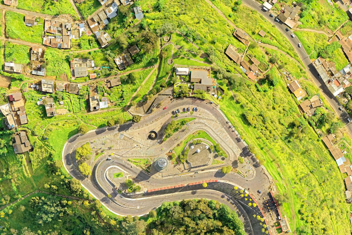
(Credit: Paul Kim ©Mapware)
Sullivan refers to the system’s submodule functionality, which allows a user to funnel different types of data into processing nodes and then string together a variety of prebuilt and custom modules into a new tool.
The result is a pixel-sorting machine that can handle a range of data analysis, supervised and unsupervised machine learning commands, and solve black-box problems as well as common geographical data analysis.
The outcome is a scalable system that can accurately label different types of trees on the map and locate the exact location of healthy bird habitat.
An abundance of data
Data is available in abundance, and VAST can handle huge amounts of it.
To test the limits, Mapware’s programmers are gathering data from a variety of sources and feeding it into the system to increase the accuracy of results. Data could come from public data sets like Landsat, Planet, Quickbird, Ikonos, and Digital Globe satellites, or from other sources like data gathered by the Air Force and U.S. Fish and Wildlife Service.

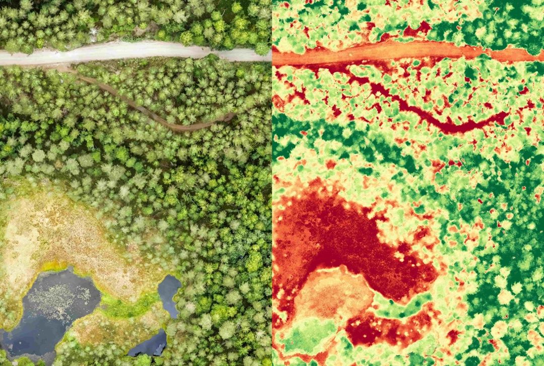
(Credit: CC-BY-SA 2019 @cfastie/Public Lab)
The National Agriculture Imagery Program (NAIP) is the go-to source for the U.S. Department of the Interior and other organizations to obtain natural-color, leaf-on data at a one-meter ground sample distance, and the data is collected every five years.
Near infrared reflectance data and normalized difference vegetation index (NDVI) data is used to gauge plant health and identify plants based on their spectral reflectance, the wavelengths of light reflected when sunlight hits the plant.
Automated analysis
Driven by the need to combine multitudes of data into a single workflow, VAST is an automated data analysis system backed by the power of machine learning and an interdisciplinary team of experts.
At Camp Bullis, VAST will allow the U.S. Air Force to make decisions about land management related to the golden-cheeked warbler habitat. At other sites, it could be scaled to include other types of habitats and different data sources from a variety of drones and sensors.
The Air Force is expecting the project to have a wide variety of applications across the organization for other sites, species, and complex problems that could benefit from powerful vegetative analysis software.
“This project is one of those rare instances where you can massively increase operational effectiveness while improving efficiency and reducing cost,” says Marc Vandeveer, AFIMSC Chief Innovation Officer. “It didn’t take me more than five seconds to recognize the potential for Air Force-wide impact, and credit goes to Air Force natural resources subject matter expert Kevin Porteck for pushing this revolutionary concept forward.”
The VAST project is a partnership between Mapware, the Air Force Installation and Mission Support Center (AFIMSC), and the Air Force Innovation Hub Network (AFWERX).
You can read more about the golden-cheeked warbler project at the Air Force Materiel Command.
Join our mailing list to stay up to date on the latest releases, product features and industry trends.
Mapware needs the contact information you provide to us to contact you about our products and services. You may unsubscribe from these communications at any time. For information on how to unsubscribe, as well as our privacy practices and commitment to protecting your privacy, please review our Privacy Policy.


