Archives
- July 2023
- June 2023
- May 2023
- April 2023
- March 2023
- February 2023
- January 2023
- December 2022
- November 2022
- October 2022
- September 2022
- May 2022
- April 2022
- March 2022
- February 2022
- January 2022
- November 2021
- October 2021
- March 2021
- July 2020
- May 2020
- April 2020
- March 2020
- December 2019
- October 2019
- September 2019
- June 2019
- May 2019
- April 2019
- September 2018
- June 2018
The Aerial Perspective Blog
Turning Drone Photogrammetry into Orthomosaic Maps

Drone photogrammetry is growing in popularity as more industries discover the value that 3D orthomosaic maps create for their internal teams and their customers. Despite this emerging visibility, many people are still unsure about what goes into an orthomosaic map and how to generate one.
In this post, we’ll explain how to use drone photogrammetry to create orthomosaic maps and address some updated best practices to help you get the results you want.
What is an orthomosaic map?
Orthomosaic maps offer a photorealistic representation of an area that can produce surveyor-grade measurements of topography, infrastructure, and buildings.
Each orthomosaic map is made up of dozens of orthoimages (also called orthophotos). An orthoimage is an extraordinarily detailed aerial photograph that is pinned to a geographic position to create continuity and uniformity when sequenced by mapping software. A dataset made up of numerous orthoimages is collected with detailed documentation on their geographic position and any external factors that could impact the collected data.
To produce a uniform scale, orthoimages are normalized for factors including altitude, lens distortion, camera tilt, and environmental conditions such as humidity. Once they’re corrected, the images can be stitched together with advanced mapping software to produce a 2D or 3D orthomosaic map.
What makes orthomosaic maps unique?
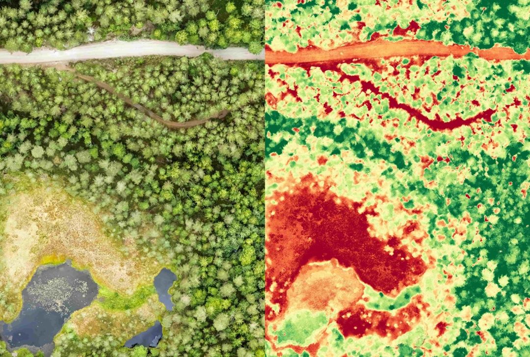
More than just a tech-savvy atlas, cutting-edge orthomosaic maps can be used to document changes in local vegetation or landscape over time, which can be helpful in a number of use cases, including environmental monitoring, emergency response, and much more.
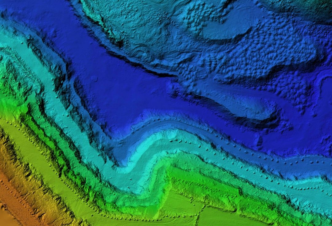
They are detailed enough to measure distance, height, and depth on land masses and human-made structures, which allows users to instantly source accurate on-the-ground conditions and information from anywhere in the world.
This emerging technology is especially valuable for industries that monitor, secure, and maintain infrastructure in distant, often very isolated rural locations—telecommunications, utilities, and oil/gas, to name a few.
What’s the difference between photos and orthophotos?
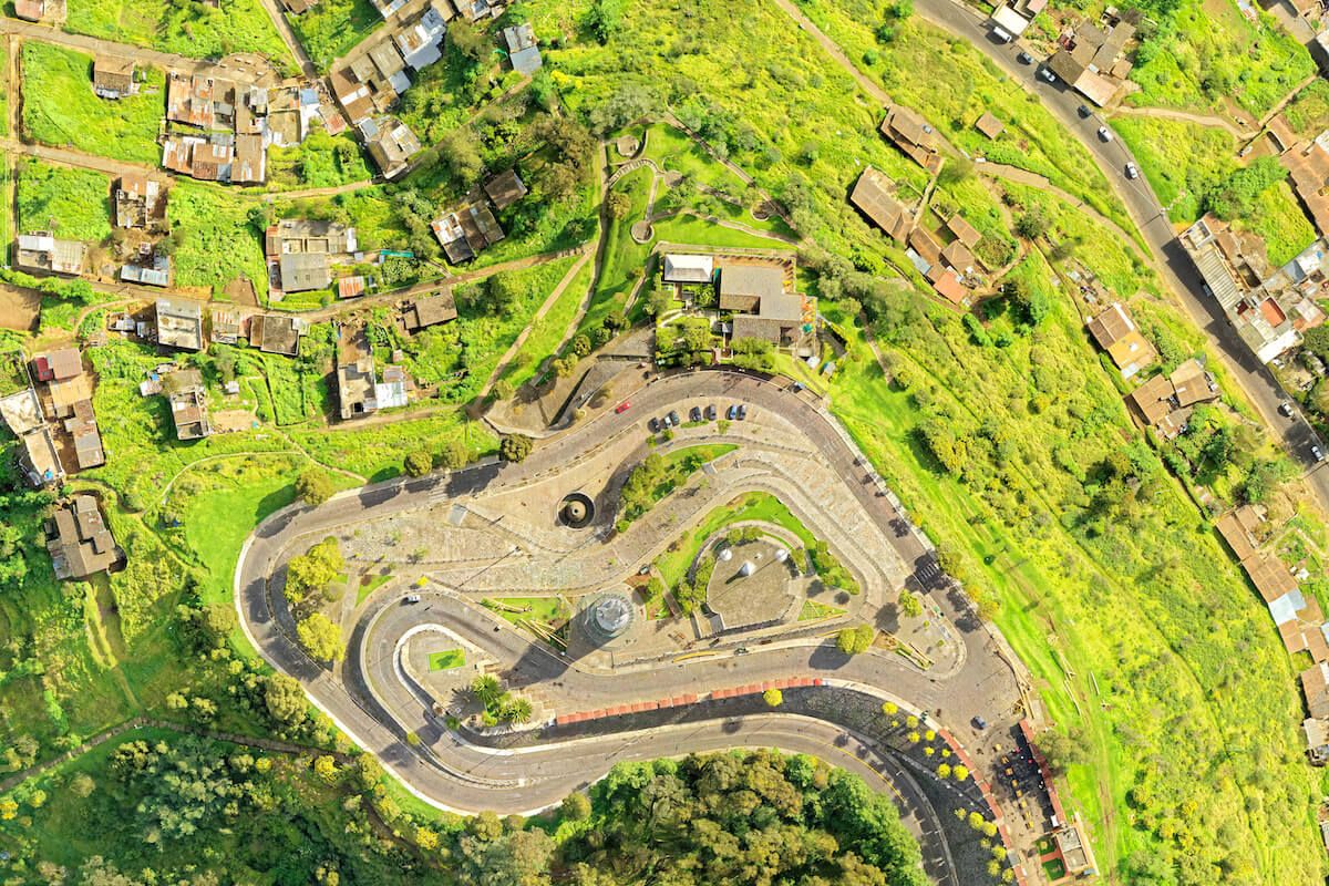
A normal aerial photo that has not been orthorectified has a perspective view. This means that you can see objects from an angle—not directly from above. With every image collected, the perspective changes, which makes it impossible to stitch the photos together to get a cohesive view.
An orthophoto has been corrected to account for the camera angle, so the view is directly from above, no matter where an object is located in the image. This consistent and more accurate view allows orthophotos to be combined to create a larger map.
Where are orthomosaic maps used?
Applications for orthomosaic maps are limited only to the imagination. Several industries have readily adopted drone mapping technology to create orthomosaic maps.
Surveying
Perhaps the most natural fit for drone mapping is surveying, the technique for determining the 2D or 3D locations of points and the distances and angles between them. Surveyors can use aerial orthomosaic maps to:
- Measure roofs.
- Create topographic maps.
- Complete land surveys.
- Map property lines.
- Generate site maps.
Agriculture
Farmers and agriculture companies have adopted drones as another tool in the toolbox for reducing their environmental impact, optimizing production, and more:
- Monitor crop health.
- Oversee livestock.
- Measure soil temperature and moisture.
- See land changes over time.
- Precisely apply pesticides and herbicides.
Public Safety
Federal, state, and local public safety officials use drone photogrammetry in both proactive and reactive ways:
- Identify emergency evacuation routes.
- Gather information remotely.
- Find hot spots in forest fires.
- Respond to natural disasters.
- Monitor traffic patterns.
Collecting orthoimages with drone photogrammetry
Traditionally, aerial photography was performed by manned aircraft or distant satellites, each of which has shortcomings. For example, airplanes and helicopters are highly susceptible to environmental conditions and human error, while satellite technology is prohibitively expensive for most firms.
UAV technology allows users to carefully map out flight plans and capture high-resolution images with minimal distortion. The ease of use and extraordinary mobility of unmanned flight makes high-quality data collection simple, safe, and accessible. Drones have also lowered the bar of entry with regards to cost, which is driving an explosion in research and innovative new use cases.
The importance of a flight plan
Producing high-quality orthomosaic maps involves detailed flight planning and data organization. When developing a flight path for a project, you need to prioritize three key factors:
- High-resolution imagery – Images collected need to be sharp, well-timed, and properly normalized. Low-quality images can lead to blurry images, vignetting, and other distortions.
- Adequate overlap – An average orthomosaic map requires overlap of around 70%, though some projects necessitate more. Overlap ensures there are no gaps or inaccuracies in your data.
- Relevant images – Nonessential views can introduce ambiguity and distortion into your map. Data sets should not include images from takeoff and landing, nor should off-angle shots taken during turns be used.
Thanks to advanced mobility and hovering, creating a tightly managed flight plan using a UAV drone makes curating high-quality images with consistency and proper alignment easier than ever.
Creating data about data
It’s not just the images themselves that make an orthomosaic map work. Metadata collected alongside each image allows processing software to build an accurate schematic from dozens or even hundreds of unique images.
In this context, metadata is a collection of data-encoded notes that are pinned to images to organize them along a flight path. It ties the image to a GIS location and provides context into other factors that may influence data normalization, such as time/date, focal length, resolution settings, and weather conditions.
Metadata should also document who created a data set and under what conditions, both factors that may influence whether data is appropriate for an orthomosaic map. Without accurate metadata, any aerial photographs collected or maps created aren’t reliable.
Turning orthoimages into orthomosaic maps
Going from a catalog of digital images to a fully dynamic 3D experience requires advanced digital processing. The tools you select will impact the quality of the map created, and unfortunately not all photogrammetry software is up to the challenge.
When shopping for a photogrammetry processing software, here’s what to look for:
- Speed – Data processing should be fast enough to not get bogged down in large data sets. Be sure to examine the technical specifications of the hardware (on-prem servers and hardware or the cloud provider’s data center, for example) as well as the software.
- Upload limits – The size of your mapping project should be limited by only your imagination. Look for cloud-based photogrammetry software like Mapware that can scale to meet project demands.
- Accuracy – Software shouldn’t introduce external distortion to data sets with poor GIS accuracy and data management practices. Accuracy tools like ground control points (GCPs) and scale constraints help to ensure the quality of your final product.
- Stability – Nothing is quite as frustrating as when software crashes and your work is lost. Any photogrammetry software should guarantee uptime and error prevention.
- User-friendliness – Creating 3D maps doesn’t have to be difficult. Find a software solution that is user-friendly when it comes to creating maps and storing, sharing, and using them.
- Pixel size: Smaller pixels mean better accuracy. Make sure the solution you choose has the resolution you need to meet your project goals.
- File options: Integrating photogrammetry into your workflow means you have to produce files that are compatible with other software. Look for software that has the export formats that work for you.
Get started with Mapware!
Mapware is powerful photogrammetry software designed by experts in the field of drone-mounted photogrammetry. It’s designed to process your images and data faster than ever, all from an easy-to-use platform.
As more innovative use cases are developed, more industries are discovering the full potential of drone photogrammetry. As drone technology advances and data and imaging software improves, the horizons of what this powerful technology can do will only grow.
Ready to put Mapware to work for you? Start a free trial today!

This post was originally published on September 4, 2020 and was updated on February 9, 2023.
Join our mailing list to stay up to date on the latest releases, product features and industry trends.
Mapware needs the contact information you provide to us to contact you about our products and services. You may unsubscribe from these communications at any time. For information on how to unsubscribe, as well as our privacy practices and commitment to protecting your privacy, please review our Privacy Policy.


