Drone Mappers: Add These Items to Your Preflight Checklist

Bolster your own safety best practices before each flight with this drone-mapper-specific preflight checklist.
Introduction
Drone mappers… you take a preflight checklist with you on every mission, right?
Right?
It’s understandable if you don’t. While the FAA does require that Remote Pilots-in-Command (RPICs) perform a preflight checklist, 14 CFR Part 107.49 is (purposely?) very high-level and intuitive. Once you’ve conducted a few flights, you can run through the FAA’s steps from memory — no sheet of paper required.
The FAA’s AC-107-2, Chapter 7.3.4 recommends a more comprehensive list of checklist steps. But even this list has a shortcoming. It doesn’t cover every mission application drones perform. Drone mappers like you have different concerns than aerial videographers or crop dusters or pipeline inspectors. Your checklist should be different, too.
Below, we’ve created a list of five items that should probably be on any drone mapper’s checklist. (Okay, it’s really five categories of items.) While this isn’t meant to be a comprehensive list or legal advice, we hope it’s a starting point for you to develop a preflight document that saves you major headaches down the road.
Checklist at a Glance
Here’s just the checklist steps the way they might appear on paper. We’ll explain each one later on:
Local Surveying Laws
My operation is legal in this jurisdiction ❑
Point of Contact: __________________; phone #: _________________
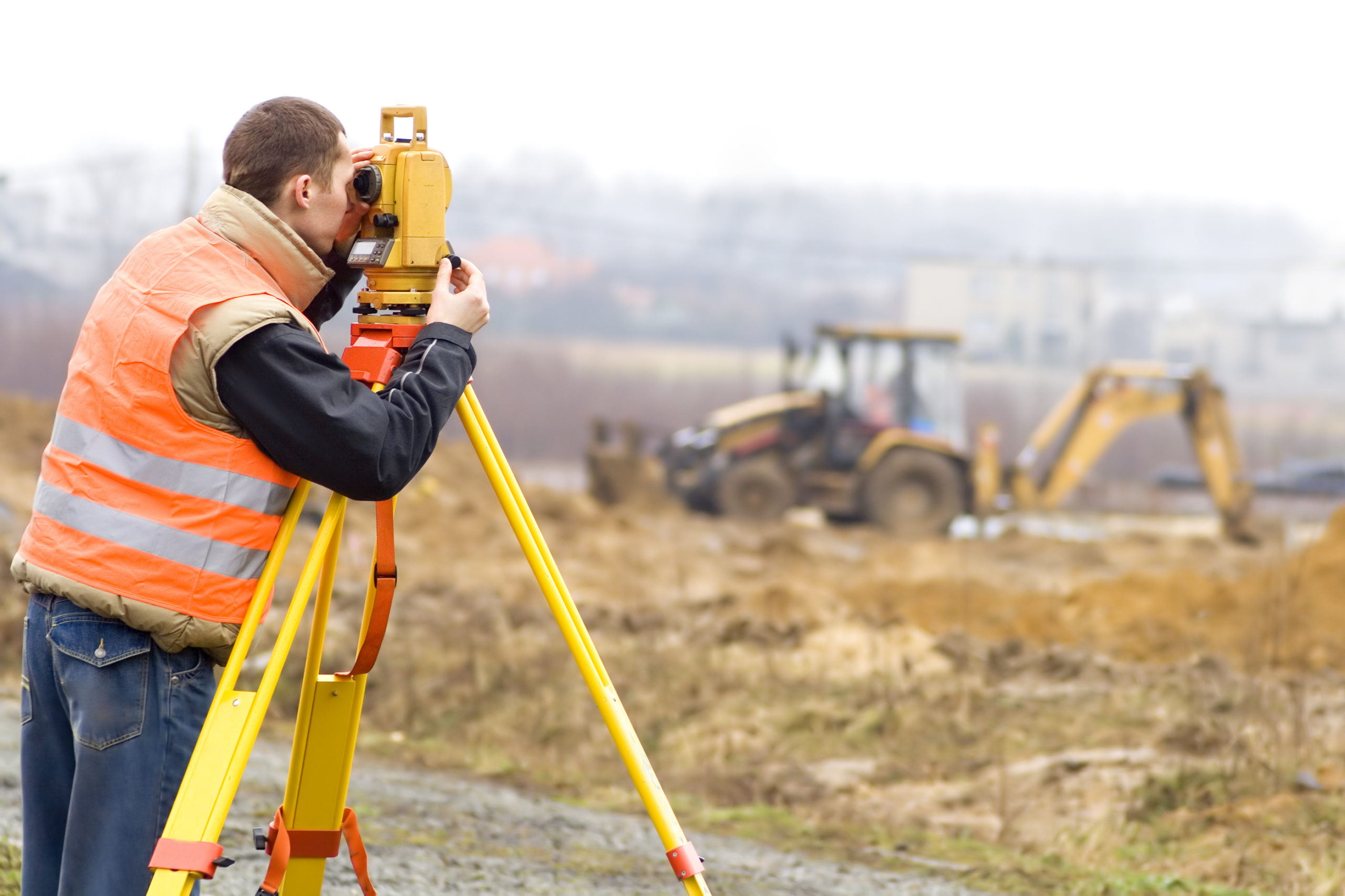
Site Inspection
Height of highest obstacle: ___ AGL
Highest site elevation: ___ AGL
Lowest site elevation: ___ AGL
Active work crew operational hours / locations identified ❑
Weather and terrain suitable for mission ❑
Supplemental Equipment
Camera ready / cover off ❑
SD card has adequate storage space ❑
Mission control device ready ❑
Flight app configured ❑
GCPs laid / coordinates recorded ❑
Mission Parameters
Flight plan created ❑
Initial mission altitude: ___ AGL ___ MSL
Drone airspeed: ___ mph
Camera angle: ___ degrees
Overlap: ___% front, ___% side
Terrain following? (Y/N)
Test Flight
Verified flight app performance ❑
Confirmed camera settings with test photographs ❑
Checklist Items Explained
Here’s why we think each of the above items is important to the mission.
Local Surveying Laws
If this is your first drone mapping mission or you are crossing state lines for a job, make sure you have the legal qualifications to practice drone mapping and that you have someone to call to verify. Some states like California restrict who can legally practice or offer to practice “land surveying” missions, and your drone mapping operation could fall into that category.
Site Inspection
You probably already include some form of site inspection in your preflight checklist, but here are a few things to note when you are doing that site walk.
Highest Obstacle
Even if you are using an automated flight planning app and flying at a fixed altitude, you should still identify the highest obstacle at your site and jot it down for reference. If you need to regain manual flight control in an emergency, you will know how low you can safely fly regardless of your drone’s position. This is a lot like the maximum elevation figure (MEF) used in U.S. Sectional Aeronautical Charts, but on a smaller scale.
Terrain Elevation
Unless you are using a flight app with terrain following, your drone will maintain a consistent altitude throughout your mission regardless of changes in elevation. So it’s important to know the difference in elevation between the highest and lowest points at your worksite. You want to set your flight plan altitude high enough to clear obstacles, but not so high that your drone exceeds the FAA’s 400 ft AGL limit as soon as the terrain dips.
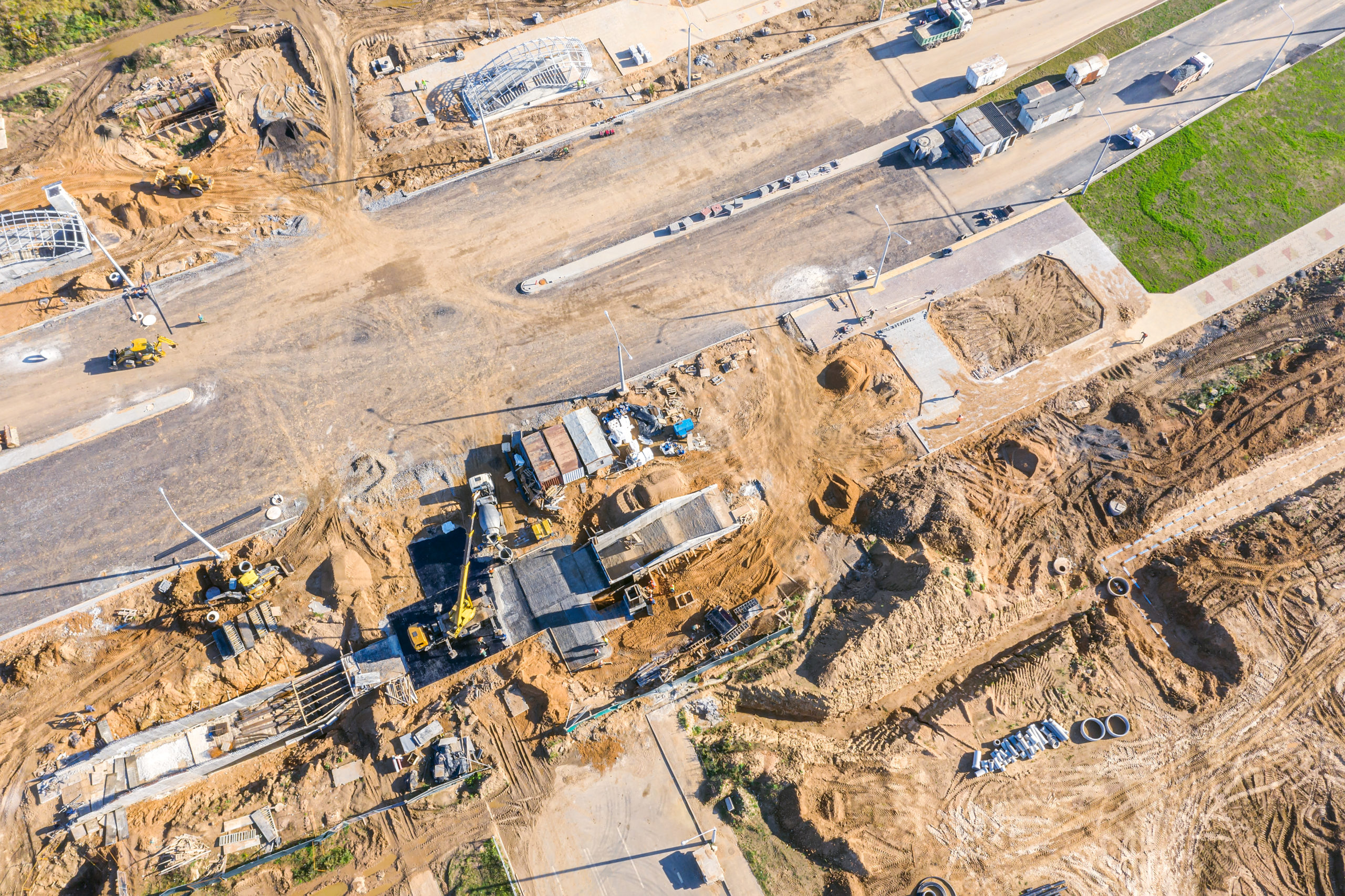
Active Work Crews
If you are mapping a construction site, a pipeline, or other active work site, there are likely to be crews at work during your mission. You should find out where they and their equipment will be on the day of your mission and when they’ll be active.
Weather and Terrain
The day of your mission, you should note environmental factors such as the position of the Sun, the cloud cover, and the air quality. Similarly, note the quality of the terrain you will be mapping — and especially any highly reflective or uniform surfaces. Even if conditions safe to fly, these factors can degrade the quality of your images and may prompt you to reschedule. For tips on ideal weather and terrain for drone mapping, check out our guide.
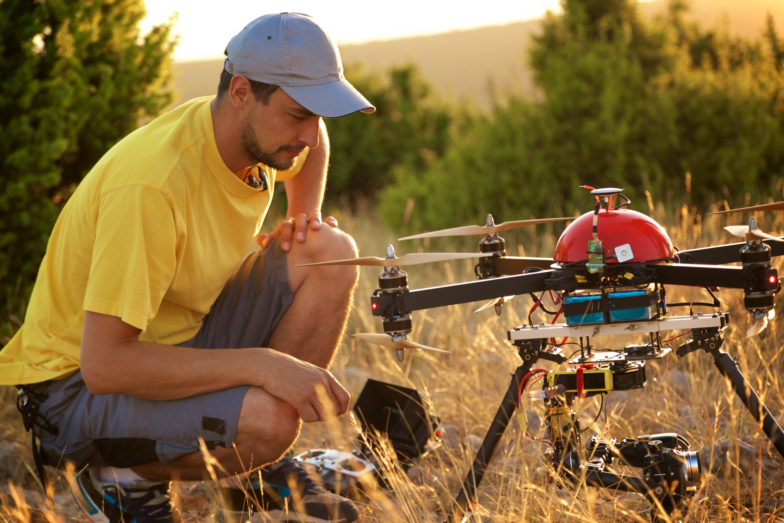
Supplemental Equipment
Below are some additional equipment checks to add to the FAA’s list in AC-107-2, Chapter 7.3.4 so your drone mapping gear is ready.
Camera
This is an obvious one, but you want to make sure your camera is uncovered and working properly before you take off.
SD Card
Some larger drone mapping missions call for hundreds or even thousands of images. Make sure that your SD card has enough free space to hold them.
Mission Control Device
If you are using a flight app, you will probably be running it on a tablet or laptop and connecting it to your drone controller. Ensure the battery is charged, the software is up-to-date, and that you have a USB or other cord necessary to connect it to your drone controller.
Flight App
Make sure your flight app is up-to-date, and — if possible — that you have pre-stored a flight plan for your mission.
GCPs
If you haven’t already, make sure you’ve placed ground control points (GCPs) throughout the worksite and recorded their GPS locations.
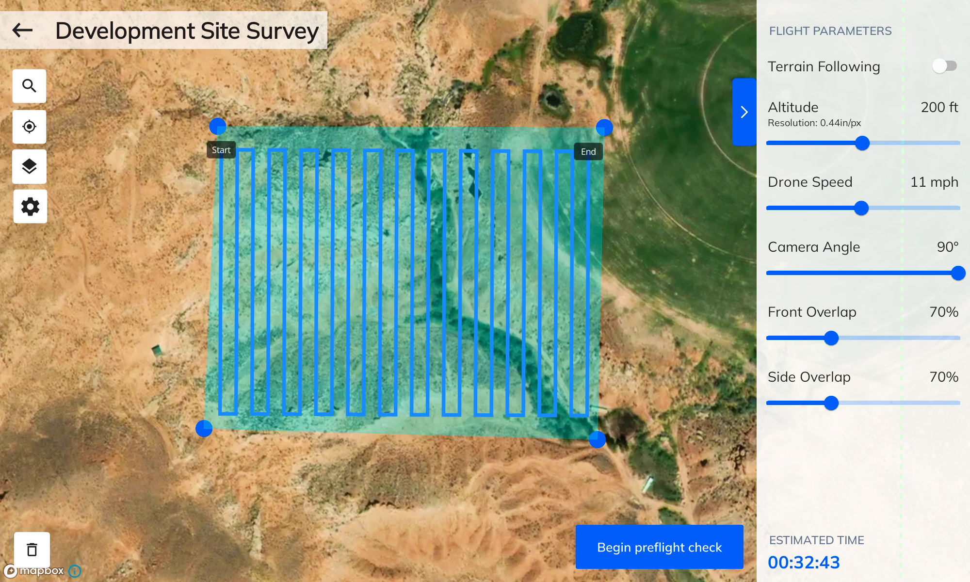
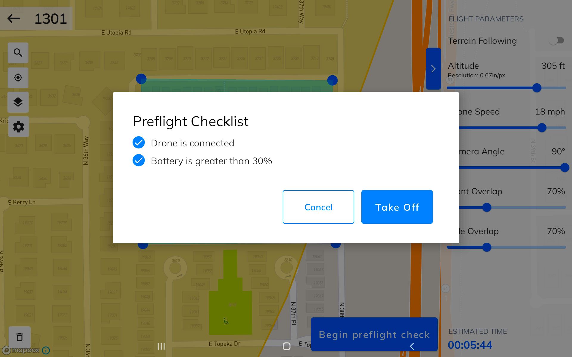
Mission Parameters
Here is where a drone mapper’s preflight checklist differs greatly from other drone operators — the mission parameters of your photogrammetry flight app. If your app allowed you to set these parameters ahead of time, you should still double-check these settings before takeoff. For guidance on selecting the best airspeed, altitude, overlap, and camera angle, check out our guide.
Flight Plan
When you get to the mission site, double-check your pre-stored flight plan or create a new one. Make sure to check local airspace for any newly established flight restrictions that may overlap your planned flight area.
Altitude
If you aren’t using terrain following, the drone will remain at its initial takeoff altitude throughout the mission. Double-check your mission altitude in the following ways:
- Ensure your mission altitude places your drone well above the height of the tallest obstacle at the highest elevation point.
- Ensure that the mission altitude is low enough to keep your drone within the FAA’s 400 ft AGL limit when you fly horizontally over the lowest elevation point.
Airspeed
Ensure that the airspeed you select is ideal for the drone’s camera and altitude, the current weather conditions, and the type of site you are mapping. For instance, if you are flying at a low altitude or with poor lighting, you may want to set your airspeed lower to reduce blur in your photos.
Camera Angle
If you are mapping relatively flat areas, taking photos at the 90-degree nadir angle is appropriate. But for vertical structures, you may want to tilt the camera angle up.
Overlap
In general, Mapware recommends 70% front and side overlap between photos. But there may be times when you want to deviate from this.
Terrain Following
Lastly, determine whether you should use terrain following. As we’ve said earlier, this feature can prevent your drone from breaking FAA regulations or flying into obstacles. But it can also improve the quality of your images.
Test Flight
It’s wise to do one or more test flights at your site before the official mission begins. Here are some things to consider.
Verify Flight App Performance
A test flight will let you know if your flight app is operating correctly:
- Make sure safety-critical settings like the return-to-home and pause buttons are responsive.
- Verify that you can override the flight plan with manual control inputs.
- Verify that the app is picking up any local flight restrictions.
- Ensure that telemetry readouts and camera feeds are reporting accurate data.
Take Test Images
Finally, take a few images from your planned altitude and airspeed. Then land and make sure that these images are adequate. You don’t want to finish a long mission only to have to discard your 200+ image set.
Final Thoughts
Traditional aviators live and die by their preflight checklists. Even though drone mappers like you don’t have the same skin in the game, you have complex missions worthy of a consistent preflight procedure. We hope our modest list inspires you to create your own.
Ready to try out your checklist with our new drone mapping app? Click here to join our beta test of Mapware Fly: https://bit.ly/3EdtN0R


