P5 POD
Single camera system built around the Phase One P5 imaging platform
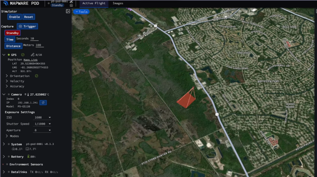
The P5 POD converts crewed aircraft into advanced aerial mapping and surveillance platforms. Featuring Phase One’s P5 ultra-high-resolution camera. The P5 POD is constructed with lightweight carbon fiber composites, for dependable performance and rapid installation for capturing high-precision data at scale
Why P5 POD?
The P5 POD redefines aerial sensor deployment by removing the requirement for permanent aircraft modifications. Built with lightweight carbon fiber and a self-contained power system, it integrates with your existing airframe in minutes via standard Meeker or custom mounting interfaces. This plug-and-play architecture allows you to convert crewed aircraft into high-precision mapping platforms instantly, capturing Phase One ultra-high-resolution data without the engineering overhead or regulatory hurdles of traditional, fixed-sensor installations.
Industry Applications
- Utility Corridor Mapping
- Perform detailed inspections of utility corridors at lower altitudes for accurate asset monitoring and maintenance planning.
- Environmental & Resource Management
- Monitor deforestation, analyze water quality, monitor species habitats, and conduct impact assessments and disaster response planning with accurate aerial data.
- Agricultural Analysis
- Collect imagery for vegetation monitoring, improve crop management, and optimize yields through precise farmland mapping.
- Infrastructure Inspection
- Efficiently and safely survey critical assets like roads, bridges, and pipelines, detecting early signs of wear or damage with high-resolution data.
- Public Safety & Emergency Response
- Provide aerial intelligence after disasters or security operations, streamlining critical decision-making with accurate mapping.
- Urban Planning & Construction
- Map large areas for city planning, land development, and construction progress tracking, reducing project timelines with reliable data capture and analysis

Toolless mounting system
P5 POD’s Specifications and Key Features
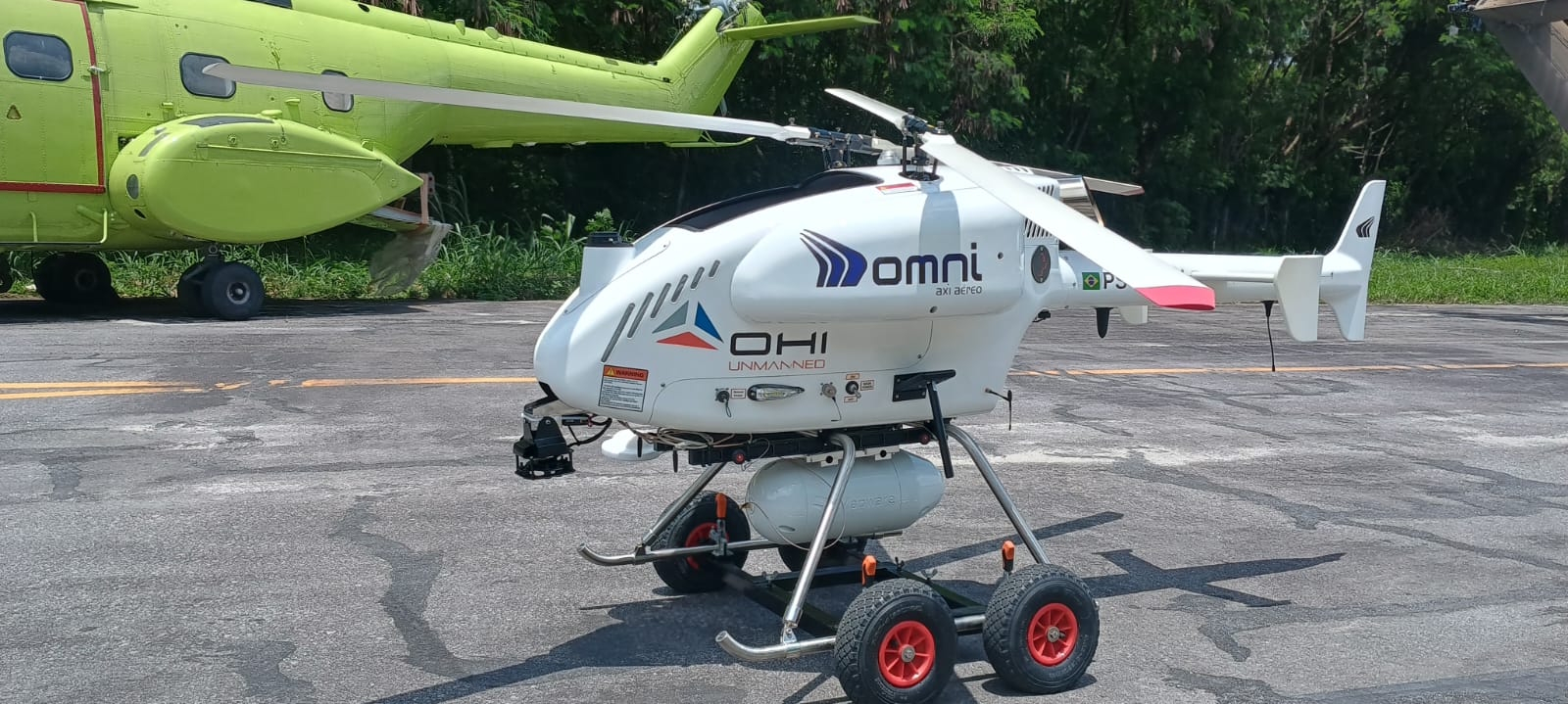
Specs | Length: 19″ Diameter: 7.1″ Weight: 14 lbs. Sensors: Phase One P5 Camera 35 or 80 mm Battery: Integrated Rechargeable 14.4V, 36Ah, 518Wh Battery Data Storage: Unified data storage. 4 or 8 TB |
Mounting | Customizable – Meeker, SwissDrones, and other system. Works with UAV, manned and un-manned aerial systems. |
Quick, Plug-and-Play Installation | Mounts on select Cessna models without aircraft modifications, installing in minutes. |
Rugged, Aviation-Grade Construction | Built to withstand environmental stresses in general aviation flights. |
Lightweight & Self-Contained | Minimizes impact on aircraft performance and fuel consumption. |
Carry-on Compliant case | Fits standard airline carry-on limits for rapid, damage-free transport. |
High-Fidelity Mapping & Surveillance | Delivers precise, large-area scans for surveying, reconnaissance, and infrastructure evaluations, enhancing decision-making with real-time and post-mission data analysis. |
Connectivity | Features Starlink connectivity for high-bandwidth data transmission and a secure VPN backhaul. |
A Proven Platform for High-Resolution Aerial Data
The P5 POD combines reliable airborne data capture with optional cloud integration, giving operators flexibility to process imagery through Mapware’s platform or their existing photogrammetry tools.