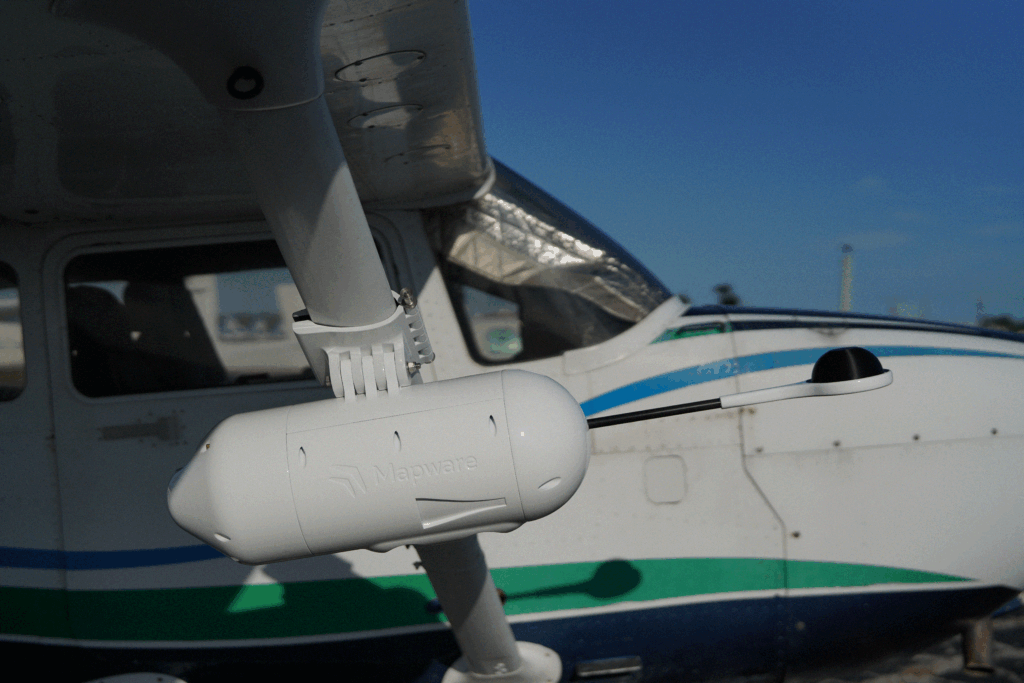
iXM POD
For high resolution mapping, vegetation analysis, and wide area capture
The iXM POD is a versatile multi-sensor platform featuring a sophisticated design that transforms crewed aircraft into advanced aerial mapping and surveillance systems. Its carbon fiber polymer construction, engineered for quick installation, delivers reliable performance and high-precision data capture. From surveying critical infrastructure to providing real-time intelligence for emergency response, it embodies the precision and clarity required for superior decision-making.
Why iXM POD?
Our POD system redefines the industry standard by moving away from permanent, single-purpose installations and rigid sensor configurations. With our no tools wing mount design and multi-sensor compatibility, you no longer need complex aircraft modifications to achieve the high-precision mapping you require. The iXM POD’s interchangeable payload system allows you to adapt to new mission requirements as technology evolves, keeping your crewed fleet at the cutting edge of data collection without additional platform investments.
Industry Applications
- Environmental & Resource Management
- Monitor deforestation, analyze water quality, monitor species habitats, and conduct impact assessments and disaster response planning with accurate aerial data.
- Agricultural Analysis
- Collect near-infrared imagery for vegetation health monitoring, improve crop management, and optimize yields through precise farmland mapping.
- Infrastructure Inspection
- Efficiently and safely survey critical assets like roads, bridges, and pipelines, detecting early signs of wear or damage with high-resolution data.
- Public Safety & Emergency Response
- Provide real-time aerial intelligence during disasters, search and rescue missions, or security operations, streamlining critical decision-making with accurate mapping.
- Urban Planning & Construction
- Map large areas for city planning, land development, and construction progress tracking, reducing project timelines with reliable data capture and analysis.
- Defense & Security
- Enhance situational awareness for border patrol, surveillance missions, and reconnaissance, benefiting from seamless sensor integration for mission-critical intelligence gathering.
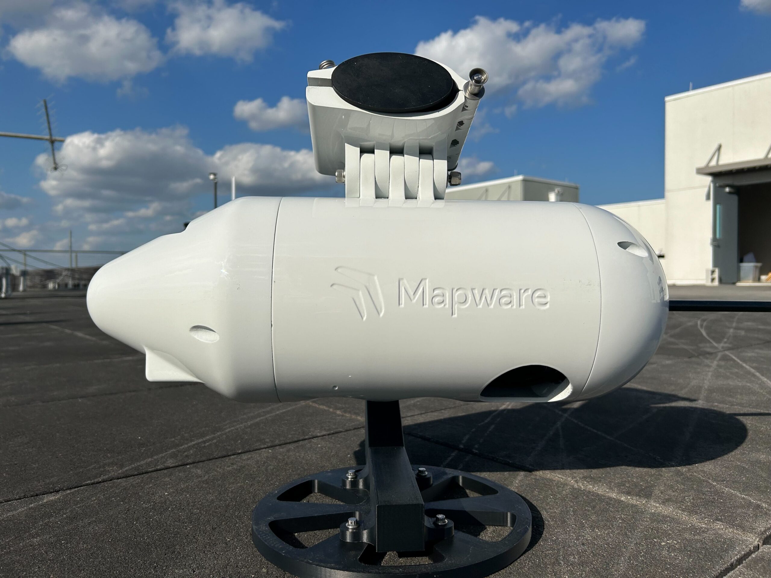
Toolless mounting system
iXM POD’s Specifications and Key Features
|
Specs
|
Length: 24 inches
Diameter: 8.5 inches Weight: 35 lbs. Sensors: Two iXM-GS120 cameras (RGB and NIR) |
|
Performance
|
Integrated rechargeable battery sustaining up to 6 hours of endurance between charges
|
|
Data Storage
|
Unified data storage with 4TB or 8 TB capacity
|
|
Connectivity
|
Features Starlink connectivity for high-bandwidth data transmission and a secure VPN backhaul.
|
|
Rugged, Aviation-Grade Construction
|
Built to withstand environmental stresses in general aviation flights
|
|
Customizable Mounting
|
Modular mounting system for operational flexibility
|
|
Lightweight & Self-Contained
|
Minimizes impact on aircraft performance and fuel consumption.
|
|
High-Fidelity Mapping & Surveillance
|
Delivers precise, large-area scans for surveying, reconnaissance, and infrastructure evaluations, enhancing decision-making with real-time and post-mission data analysis.
|
The Future of Aerial Data Collection
With consistent performance in real-world operations, the iXM POD has earned a reputation for dependable, high‑precision flight—ideal for mission-critical imaging, inspection, and surveying applications.
