The Aerial Perspective Blog
What Is an Orthomosaic Map, and Who Does It Help?
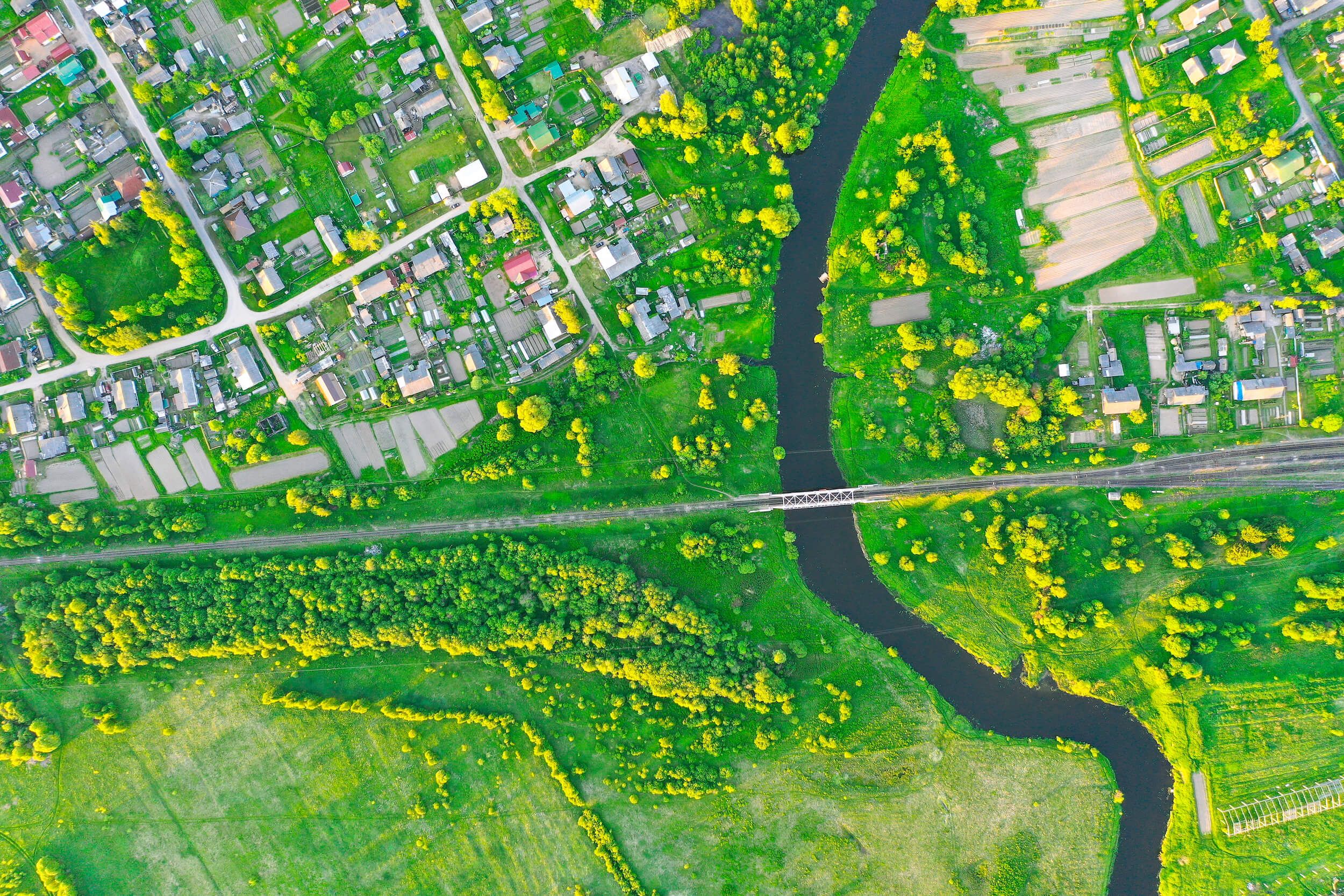
Drone photogrammetry is increasingly being used in a broad range of industries and government applications. Using software, the images that drones collect can be turned into maps that allow you to accurately measure true distances and volumes to get a better understanding of the spatial relationship between structures and other objects. The process to create an orthomosaic starts by capturing drone images, which are then translated into a map-quality image.
What is an orthophoto?
Unlike a regular aerial photograph that gets distorted by the perspective of the camera, an orthophoto is normalized so that it provides a purely top-down view. In an orthophoto, you can’t see the sides of buildings—just the view from directly above, much like a map.
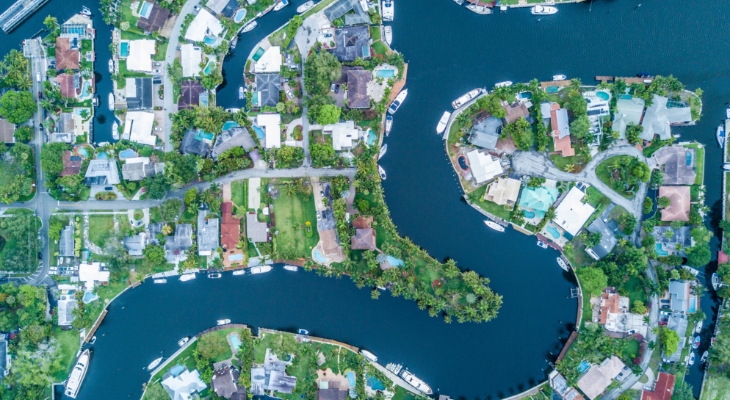
To achieve this, orthophotos are geometrically corrected to eliminate the perspective view from the camera angle. Because of this correction, orthophotos are more accurate than aerial images and can be used for measurements in the same way that maps can.
What is an orthomosaic?
An orthomosaic is essentially a large map that is made up of smaller orthophotos. Each aerial photo that a drone pilot captures is pinned to a geographic position. Photos need to have an overlap of at least 70 percent to create an accurate picture and only include relevant images (not takeoff or landing). This is why flight planning is so important.
Mapping software uses geographic data to seamlessly stitch the images together. It’s like a 3D puzzle that forms a cohesive high-quality image once all the pieces are assembled. Of course, drones don’t capture images that are perfect puzzle pieces. The photos have to be normalized for factors such as:
- Altitude
- Lens distortion
- Camera tilt
- Environmental conditions
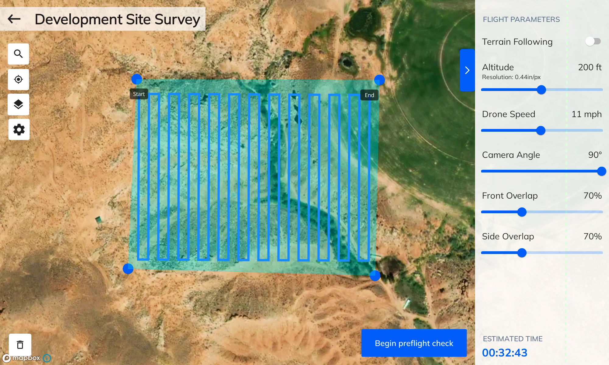
Once normalized, the photos can be combined to make a 2D orthomosaic. The result is highly accurate images that can be used to measure topography, buildings, materials, and more. Users can zoom in to get highly detailed information and use software to calculate distances, count items, and so on.
How can an orthomosaic be used?
Orthomosaic maps are used in a wide range of government applications and private sector industries, and the list is growing longer every day.
Environmental Monitoring
Orthomosaic maps created from drone imagery can be used in a broad range of environmental monitoring applications, including:
- Capturing changes in vegetation
- Creating remote sensing maps to identify encroachment of invasive species
- Identifying soil erosion patterns
- Viewing changes in the landscape over time
- Evaluating habitat conditions of protected species
- Analyzing water levels
Because they are such powerful tools, government agencies have launched initiatives such as the Environmental Protection Agency (EPA) Unmanned Aircraft Systems (UAS) program for site mapping, terrain modeling, and more.
Disaster Preparation and Response
The United States Department of Agriculture (USDA) uses drone services to identify high-risk conditions and to help fight wildfires. Municipalities can also use orthomosaics produced by drones to assess damage after a natural disaster or emergency and coordinate responses with as much information as possible. To prepare for these unpredictable events, drone mapping of high-risk areas helps identify evacuation routes and prepare tactical responses.
Engineering and Construction
Whether designing for the private sector or government projects, architects, engineers, and contractors can use drone mapping to gather:
- Site access details
- Infrastructure measurements
- Measurements to estimate material costs
- Progress photos of construction sites
- Inspection photos after building completion
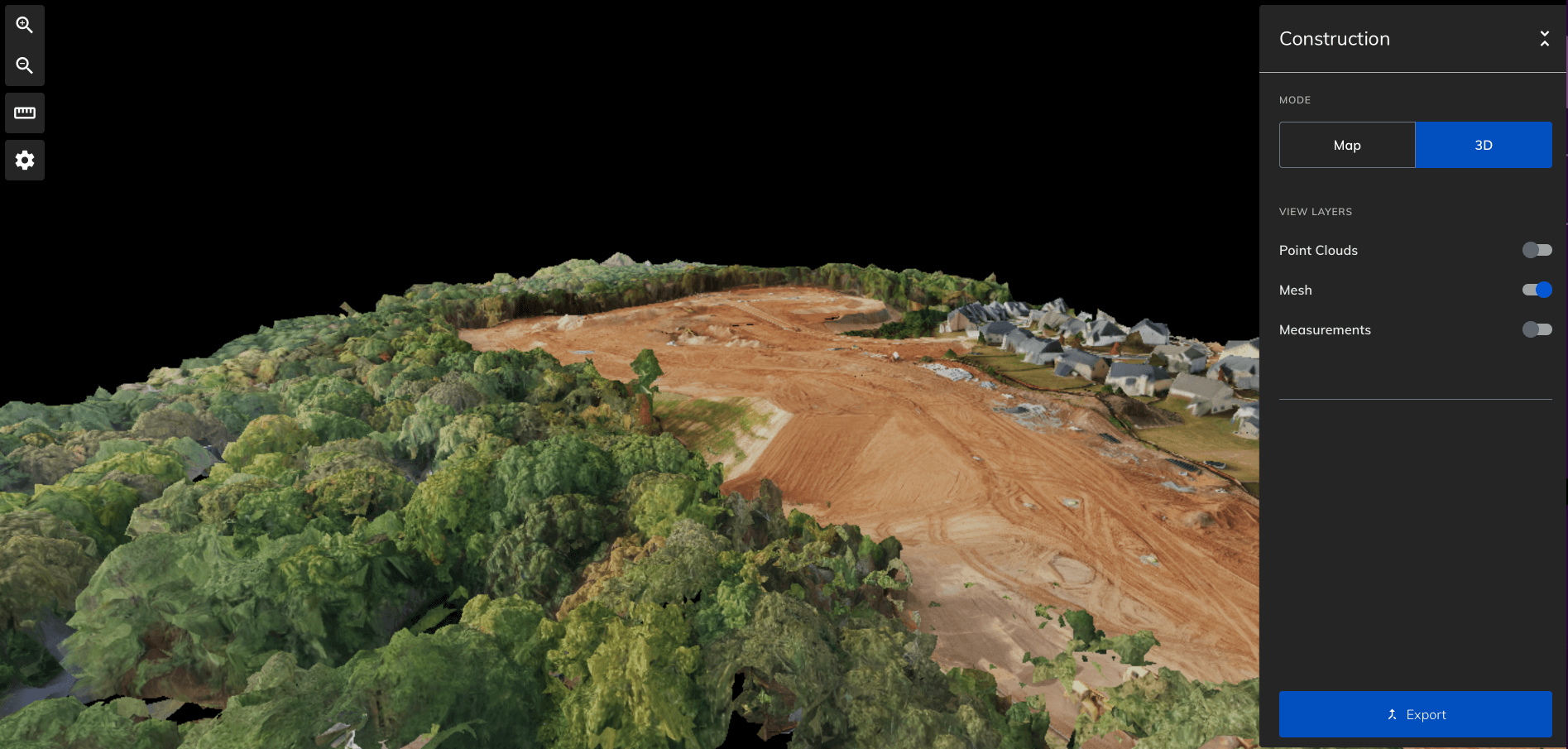
From assessing the site to capturing as-built images, drones can be incorporated into every phase of a construction project to efficiently provide valuable data.
Telecommunications and Utilities
Utility companies can use drones to monitor conditions in remote and difficult-to-access areas without deploying costly field crews. Drones can also be used to explore the unknown and assess site conditions for expansion into new areas, including those where roads do not yet exist.
Agriculture
Farmers, ranchers, academic programs, and government agencies use drones to:
- Assess crop health
- Compare conditions from prior periods
- Test different seeds, fertilizers, and soils
- Count livestock
Recently, the USDA has used drones to research irrigation water quality to develop new safety standards for the agriculture industry.
Create orthomosaics with Mapware.
With Mapware, you can create a flight plan that allows you to capture high-resolution photos with the correct amount of overlap. Mapware software allows you to turn those images into an orthomosaic map that you can use to compare previous maps, take measurements, or whatever your specific application requires. No matter what sector you work in, chances are you can rely on drones to capture data more accurately and efficiently.
Ready to put Mapware to work for you? Start a free trial today!
Join our mailing list to stay up to date on the latest releases, product features and industry trends.
Mapware needs the contact information you provide to us to contact you about our products and services. You may unsubscribe from these communications at any time. For information on how to unsubscribe, as well as our privacy practices and commitment to protecting your privacy, please review our Privacy Policy.
