The Aerial Perspective Blog
Mapware Wins $6 Million Air Force Award

In a four-year R&D project, Mapware will develop a suite of advanced drone technologies that will be used to monitor a wide range of environmental characteristics at military bases across the U.S., including endangered and invasive species, animal behavior, and habitat conditions. The project is backed by a $6 million contract awarded Mar. 12 by the U.S. Air Force at the AFWERX Virtual Spark Collider, Pitch Bowl, and STRATFI Showcase event.
With the Air Force Phase II Strategic Interest award, Mapware will work with partners to develop new photogrammetry technology, computer vision software, and specifications for drones to be used in environmental use cases. The result will be a suite of advanced technology that puts complete situational awareness at the fingertips of military personnel, so they can survey lands efficiently without sending teams into the field or hiring planes to survey and process data.
The technology is designed for those who serve as custodians of U.S. military properties, which contain a huge variety of wildlife, to identify target plants, animals, and other features using unmanned aerial systems (UAS), or drones. Using machine learning, the system in development automates the processing of drone data and allows the combination of data sets to create a robust picture of the environment based on 3D modeling technology and AI.
“We’ve been working with the Air Force for the past year on a pilot project to develop advanced drone software, and now we’ll have the support we need to expand it into some really exciting technology,” CEO Joe Sullivan said. “The use cases are fascinating, from polar bears and whales to birds and fire prevention. We can’t wait to dig into the project and bring these technologies to life.”

Fierce Competition
To win, Mapware had to vie for a place among a pool of competitive startups working in a wide variety of technology sectors, who were invited to submit proposals in three submission rounds between October and February. The competition was created by the U.S. Air Force AFWERX technology accelerator program, which boosted its funding this year as part of a Department of Defense initiative to outpace its global competitors in science and technology innovation.
It also aims to help startups bridge the “valley of death” where funding runs out before projects mature, making it possible to rapidly unleash disruptive technologies. Twenty-one final winners were selected for the Phase II Strategic Interest award, and a total of $580 million in small business funding was garnered this year under the AFVentures Strategic Financing (STRATFI) program.
The goal of the competition, which is in its first year and held in cooperation with the U.S. small business innovation research (SBIR) seed fund, is to modernize the government procurement and acquisition process. It combines seed funding, government support, and commercial partners to work closely to bring technology to the market more quickly and create capabilities that meet the strategic goals outlined in the U.S. Air Force Science and Technology Strategy.
The technology Mapware is developing serves the need for global persistent awareness, resilient information sharing, and rapid, effective decision-making by providing tools for autonomous data collection and processing.
The award includes $6 million and four years of R&D support, plus $6-40 million in commercial partnership support, with releases of bundled, dual-use technologies hitting the commercial sector along the way. The outcome is a system of innovation that pumps the U.S. manufacturing sector and serves commercial partners while amplifying the military’s ability to produce new technologies.
The project is supported by Mapware’s partners at the Air Force Installation and Mission Support Center (AFIMC), the Air Force Civil Engineer Center, Air Force Materiel Command, and their relationship with AFWERX.

Multi-Year Air Force R&D
Throughout 2019, Mapware worked with the U.S. Air Force to develop drone-based environmental monitoring technology and shape an expanded vision for its use. The project began with a one-year, Phase II contract for $750,000 to perform field tests at the Camp Bullis Military Training Reservation near San Antonio, Texas.
The Camp Bullis project included drone surveys of a 300-acre test site to determine the location of habitat of an endangered bird, the golden-cheeked warbler, in order to meet Department of the Interior, Fish and Wildlife Service requirements to protect the species.
Read More: “Mapware is Helping the U.S. Air Force Protect Endangered Birds”
With a relationship already established through the golden-cheeked warbler project, the current Phase IIB strategic funding award expands that project from one use case in Texas to 37 possible use cases in 19 missions at locations across the U.S.
The Air Force submitted a list of drone-related technology for which they have an immediate need in order to minimize the man hours and expense associated with understanding the environment at military installations and meeting DOI requirements. That wish list includes surveying land for birds, trees, grasses, turtle nests in the sand, eagle’s nests, and a huge variety of other environmental monitoring needs. Mapware says the project could save the U.S. Air Force $8-16 million annually.
“We get to help save bald eagles, how cool is that!” Project Manager Tony Roman said. “I mean, this project has a lot of use cases for different interesting animals and places, with assessment of habitats and vegetation. But the best is we get to look at bald eagles, golden eagles, map their nests, count them, see what that says about their health.”

Why Mapware?
Mapware has a history of helping first responders and companies rapidly locate critical infrastructure and damage to the environment in the aftermath of some of the major hurricanes that made landfall in the U.S., including Irma in 2017 and Florence in 2018. They also worked with Comcast after Hurricane Matthew in 2016, with disaster recovery company Belfor after Hurricane Michael in 2018, and with Austin, Texas-based energy utility companies.
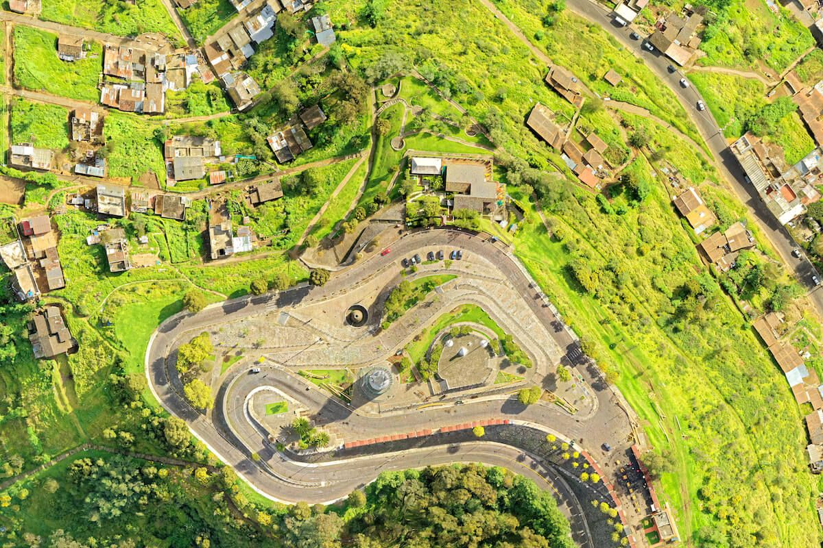
In less urgent times, the same technology can be used for predictive maintenance, to survey pipelines, map coastlines, or monitor landscape trends. It’s the science of photogrammetry, and it’s about stitching together hundreds of images taken by a drone to create orthomosaic maps and 3D models—digital twins—of the world around you.
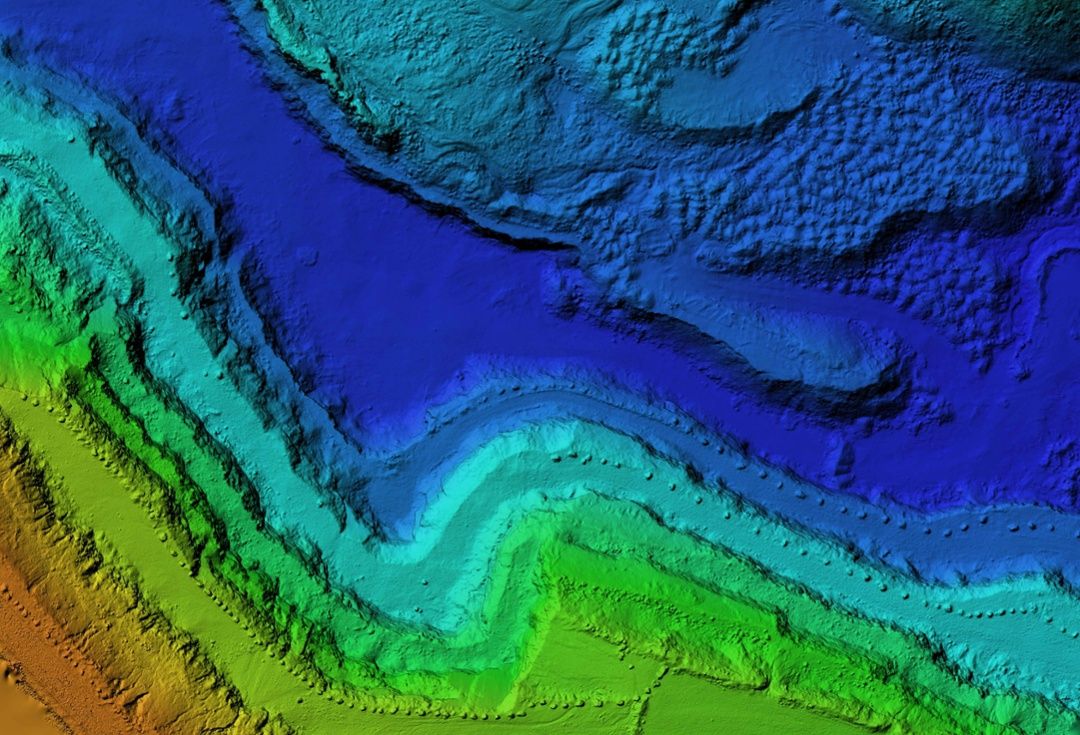
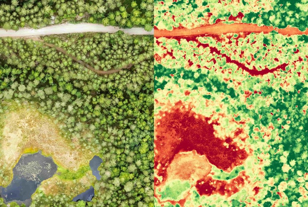
With good data, every detail can be represented in software that allows you to explore information through colorful data visualizations and output different 3D formats. Depending on the set of sensors the drone is carrying as a payload, it can collect data in multispectral wavelengths and scan using radar or lidar.
Augmented with machine learning, drone photogrammetry software becomes a computer vision tool infused with the power of artificial intelligence, so it can not only process data collected by drones, but combine it with other big data sets and be trained to assess forests, trees, and grasses, to identify endangered species habitat, and track growth patterns of fire-resistant plants. The possibilities for the technology’s use in environmental monitoring tasks are broad, and the Air Force-funded project will address many of these needs.

Over the four-year contract, the R&D process will include exploring the science of sensor fusion, developing cutting-edge mathematics for computer vision algorithms, training systems for advanced feature detection, and increasing photogrammetry accuracy by paying special attention to the GPS input throughout processing. Mapware’s team is already developing the algorithms to perform these object-detection tasks, and they are breaking new ground in the science of photogrammetry and AI-infused data processing.
“The results of our studies will not only be publishable but, in concert with efforts to parallelize the computations, will have the promise of achieving a new paradigm in the merger of lidar, computer vision, and machine learning,” mathematician Dr. William Franklin said.

Primed for Success
With a self-titled “serial entrepreneur” at the helm, the company, led by CEO Joe Sullivan, has raised $5.5 million in venture capital and is no stranger to successful tech incubation. Mapware is an alumni of the Capital Factory Accelerator Program, the NVIDIA Inception Program, winner of the MD5 hackathon for implementation of AI/ML techniques for image analysis, and the recipient of FastCompany’s Innovation by Design Award for Social Good.
The team consists of three co-founders, CEO Joe Sullivan, Chief Marketing Officer Jeff Brooks, and Chief Technology Officer Nathan Sullivan, and a multidisciplinary staff working on advanced drone-related technologies like photogrammetry, AI-infused data analysis, and 5G-enabled drone software. The company is rapidly growing, with staff expected to double this year and more growth to come as more projects are launched.
“We’ve always seen UAS and AI as transformational tools that provide highly-skilled workers the insights they need to take on tomorrow’s biggest challenges,” Chief Marketing Officer Jeff Brooks said. “The ability to assess, understand, and forecast our physical environment is as critical to the thriving of bald eagles as it is to the survival of deployed airmen and American industry.”
The company is also among the first cohort of startups chosen to focus on putting lots of high-resolution, accurate data into the hands of first responders quickly, whether they are deployed to search for victims or to repair critical infrastructure like towers, roads, or utilities. High-speed 5G networks are essential to that capability.

The Air Force also has interest in optimizing 5G capabilities to expand its network capabilities and make full use of the solutions enabled by ubiquitous connectivity and the internet of things. The Strategic Interest Phase II contract award serves that mission and creates a partnership that allows Mapware and the Air Force to develop the underlying technology to help 5G and drones work together and build new tools for monitoring the environment.
“Mapware has been a fantastic and talented partner and are well positioned to deliver this advanced drone imagery and machine learning capability for multiple installation and mission support enterprise uses,” AFIMC Chief Innovation Officer Marc Vandeveer said. “We look forward as this innovative partnership grows over the next four years.”
Read more about the project from the U.S. Air Force.

Join our mailing list to stay up to date on the latest releases, product features and industry trends.
Mapware needs the contact information you provide to us to contact you about our products and services. You may unsubscribe from these communications at any time. For information on how to unsubscribe, as well as our privacy practices and commitment to protecting your privacy, please review our Privacy Policy.


