The Aerial Perspective Blog
How Drones Supercharge GIS Management

Intro to GIS and UAVs
Geospatial Information Systems (GIS) are an indispensable tool for many modern industries. With applications in construction, real estate, agriculture, city planning, public health and safety, and more, the diverse capabilities of GIS systems enable them to meet a wide range of business needs. However, GIS relies heavily on the underlying data that supports it, and gathering that data can be burdensome.
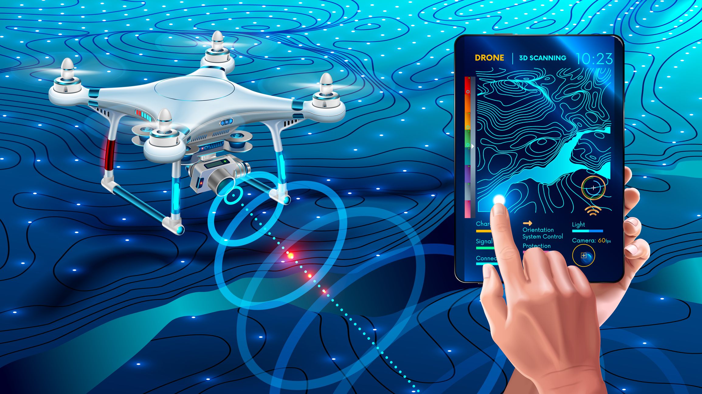
Like GIS systems, drones–or unmanned aerial vehicles (UAVS)–are flexible tools able to satisfy a wide range of professional needs. The advent of light-weight, high-performance drones has disrupted many industries in the past decade, a trend that won’t slow down anytime soon. With the ability to autonomously collect a range of data, businesses of all types are racing to take advantage of drones. In fact, the FAA estimates that by 2022 there will be nearly half a million registered commercial-use drones in the United States (Source: FAA 2018 – 2038 Aerospace Forecast.)
With such new and uniquely augmentative capabilities, it was inevitable that GIS and drone technology would collide–no pun intended. These two game-changers were truly made for each other. A GIS system is only as good as the data you feed it, and UAVs can quickly and inexpensively feed them a stunning array of data. But, utilizing UAVs for data collection is no small task. The type of project dictates the kinds of sensors that are needed, and which type of drone is needed. There’s no one-size-fits-all solution. And, there are other hurdles, including regulatory requirements and software limitations. But, the promise of unparalleled agility in the field makes the time and resources required to set up a UAV program worth it for many GIS professionals.
GIS Data Capture
Most GIS systems rely on a handful of common data-capture methodologies. Vector or raster data can be created from existing maps, but this method runs the risk of digitizing outdated information, thereby placing bad data into the GIS database. There are many modern survey tools, including GPS and Coordinate Geometry (COGO), which have the advantage of providing more up-to-date information.
The proliferation of satellites has enabled a wide range of remotely sensed data to be used for mapping, but satellite imagery frequently displays low fidelity. For geospatial data-collection projects that require high precision and accuracy, there’s simply nothing that can match an aircraft equipped with the latest in high-tech remote sensors.

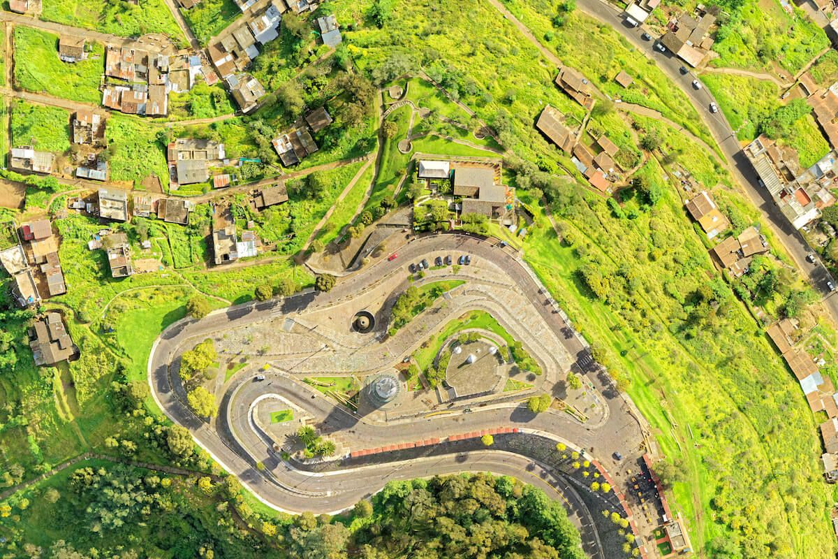
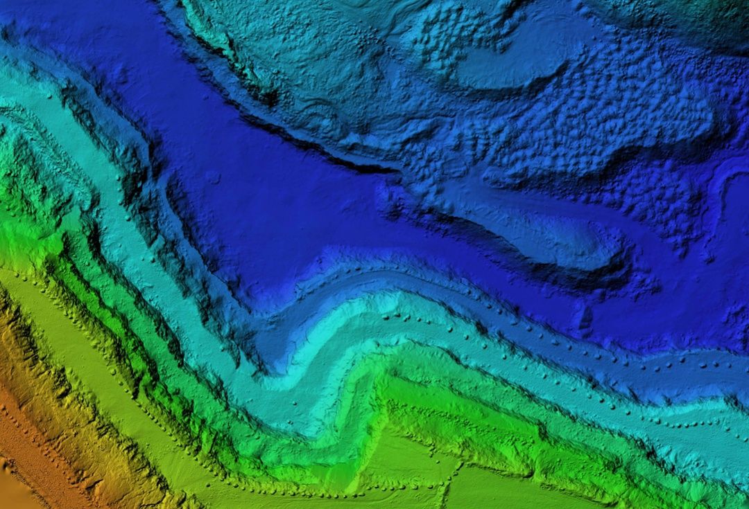
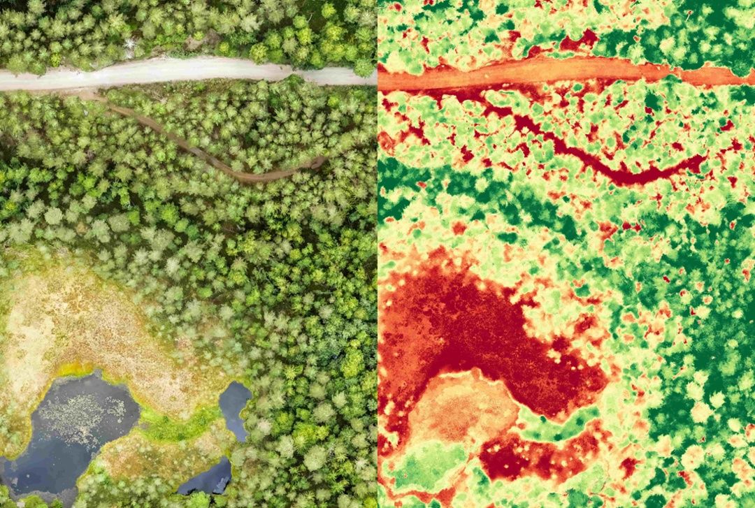
Airborne remote-sensing instrumentation is frequently used for GIS data-collection projects that demand a very high degree of rigor. Aircraft are equipped with instruments that include hyperspectral imaging spectrometers and Light-Detecting Radar (LiDAR), while high-resolution RGB cameras fly over an area and gather specific types of information. Data gathered by these sensors is used to construct accurate models of terrain and ground features. One popular technique is photogrammetry, where many overlapping photos are taken and used to determine exact measurements between objects.
All of this requires high-precision instrumentation, trained aircraft operators, and favorable weather conditions in order to work. And even then, traditional aircraft are prohibitively expensive to operate and skilled pilots can be difficult to find. There are also environmental and safety concerns. More and more, UAVs are becoming the favored solution for remote-sensing.
How Drones Can Help
In the past decade, UAVs have moved from the hobbyist’s garage into professional industries in a major way. It makes sense, given that drones provide some big advantages over traditional aerial vehicles. The cost savings of using drones is one major draw, as even a top-tier drone chock full of the latest features costs a mere fraction of what a small airplane or helicopter costs. Significant fuel savings add to that bottom line. Drones are nimble, and are capable of hovering in place and accessing small spaces that larger aircraft can’t. Drones can be deployed quickly, and commonly flown routes can be automated, minimizing human involvement (and human error). They’re also environmentally friendly and greatly reduce the risk of damage to persons or property.

How much money can operators save by utilizing drones instead of manned aircraft? One example of what is possible can be seen in the Mesa County (Colorado) Landfill Project, a joint project between the United States Geological Survey (USGS), The Bureau of Land Management (BLM), and the Mesa County Sheriff’s Department. The Mesa County Landfill personnel are faced with the task of reporting waste material volume to the EPA on a quarterly basis.
The cost of utilizing a contractor to fly over the landfill and perform a volumetric compliance inspection amounted to roughly $10,000. The cost of using a drone to do the same task? $300.
The project was so successful that the Mesa County Sheriff’s Office built an entire Unmanned Aerial System (UAS) Team. To date, the UAS Team has assisted with fatality crashes for the Colorado State Patrol, wildfire monitoring for the Grand Junction Fire Department, suspect apprehension, and more.
Maneuverability is another area where drones have a big advantage over manned aircraft. A drone can fly much closer to the ground, and safely, in ways a helicopter or airplane simply can’t. They are small, which allows them to access tighter spaces, and they can hover–a feature that allows them to gather certain types of data more precisely. Many utilities are utilizing drones for precisely this reason. Senior GIS Analyst Eddie Taylor from Santee Cooper, South Carolina’s leading power company, states: “These drones can provide visuals of areas we either cannot or should not access. Transmission rights of way often go through swamps or other areas with limited or difficult access. These drones provide up-close views of the conditions of poles, wires, insulators, and other hardware that may be damaged or in need of maintenance.” (Source: T&D)
Challenges to Starting a Successful UAV Program
While it may seem like there’s no reason for GIS professionals NOT to utilize drones for data collection, starting a successful UAV program is rife with challenges. Despite technological advances, drone tech is still in its adolescence, and has certain limitations. The autonomous nature of driverless vehicles like drones makes them subject to certain types of interference. And, though manned aircraft are subject to far more stringent regulations, drones are also subject to FAA rules of their own. Like their manned counterparts, each drone is different, requiring would-be operators to learn the various ins and outs of the hardware before they can fully utilize it.
The physical limitations of drones are few, but they could be significant. For one, most drones are small, which limits the payload they are capable of carrying. Tempering this disadvantage is the fact that because drones can fly so close to the ground, the sensors they require are smaller and lighter. Nevertheless, if many different sensors need to be used at once, one drone may not be able to do it all, and the amount of data generated by multiple sensors and multiple drones can create another problem drone operators are all too aware of: data overload.

Data overload occurs when there is more data available than can be transmitted or used at one time. Drones are great at collecting a wealth of data, but parsing that data to make it useful–and then transmitting it wirelessly to its final destination–is challenging. The problem scales with data-collection capabilities, too: the more data you can collect, the more difficult it is to organize it and relay it. Software solutions to this issue have emerged, though. Mapware is one company working diligently to make data overload a thing of the past.
Another limitation in drone tech is flight time. Most drones rely on batteries as a power source. Battery technology is improving, but it is still not able to compete with fossil fuels in cases like this. Batteries are also relatively heavy, adding to the payload, and a higher payload means a shorter total flight time. For GIS projects requiring data collection over long distances, drones may not be the best solution.
Because drones are piloted autonomously or remotely, they rely on GPS to triangulate their own position in the sky. GPS navigation of this type is susceptible to data-interruption from solar flares and other forms of wireless interference. And, like any computer system, control of a drone could be seized by hackers to steal information or use it for nefarious purposes.
Government regulation has scared a few would-be UAV operators away from using drones commercially. While in flight, drones occupy airspace–which means they are regulated under the jurisdiction of the FAA. Hobbyists flying “model aircraft” for recreation are not required to obtain FAA approval, but the same is not true for commercial entities. Commercial UAV usage requires operators to obtain operating approval and use FAA-certified aircraft and pilots. Many drones have not been granted certified aircraft status by the FAA, meaning they cannot legally be used for commercial purposes. It’s still not clear what the future holds for UAV regulation. That lack of clarity is discouraging to organizations interested in building UAV programs of their own. This is one major reason why those new to UAVs should consider working with a certified drone operator first.
The Final Word
The ability of GIS to display complex geospatial information in a meaningful way, and UAVs’ ability to collect the requisite data quickly and inexpensively, make these two technologies an outstanding combination. Drones have improved the GIS data-collection process in almost every regard, and will continue to do so for the foreseeable future. But, before GIS professionals can reap the benefits, they must understand the complicated and sometimes confusing landscape that exists in the world of commercial UAVs.
Learn more about the world of commercial UAVs. Contact Mapware

Join our mailing list to stay up to date on the latest releases, product features and industry trends.
Mapware needs the contact information you provide to us to contact you about our products and services. You may unsubscribe from these communications at any time. For information on how to unsubscribe, as well as our privacy practices and commitment to protecting your privacy, please review our Privacy Policy.


